Cartographic Information in Digital Form at the University of Chicago Map Collection
Cartographic information is increasingly stored as digital data. There are enormous advantages to this form of storage. Maps based on digital data can be updated or redesigned with a few keystrokes. Map users can control such elements as scale and color; can include only such information as they are interested in; and can use a "geographical information system" (GIS) to combine data from several different sources in one map.
The University of Chicago Map Collection has acquired a great deal of cartographic information in digital form as well as some software and hardware with which users may view and print maps generated from these data.
The following pages contain a description of parts of the Collection's holdings as of mid-2014. Many additional holdings can be found in the Library's on-line catalog by doing a keyword subject search on the genre/form term "Geospatial data" or a combination of the form subdivision terms "Maps" and "Databases." A huge amount of geospatial data can also be downloaded for free.
Please note that, with some exceptions, the Map Collection's paper map holdings can usually provide spatial information in greater detail and for a wider variety of periods than its holdings of digital cartographic data. Digital cartography typically works best for the production of thematic maps and relatively simple general maps. It is possible to georeference paper maps and to use the files as "raster" data, or, with considerably more effort, to compile vector data files from them.
Major Software Package
Environmental Systems Research Institute. ArcGIS 10.3. Redlands, Calif. : ESRI, 2014. Can be used to make maps from a great number of different types of spatial data. including raster data.
Highly Selected ArcGIS Data Sets
The atlas of religions in China = Zhongguo zong jiao di tu. Ann Arbor, MI : University of Michigan China Data Center, 2010. geospatial data for the distribution of religions in China.
Australian Geological Survey Organisation. National Digital Geoscience Data Sets. [Canberra] : AGSO, 1998. Geology and other data sets for Australia.
Beijing Hua tong ren shi chang xin xi you xian ze ren gong si. Census data with maps. [Beijing] : All China Marketing Research Co., [2005]. Data and boundary files for Chinese 2000 census.
Beijing Hua tong ren shi chang xin xi you xian ze ren gong si. Historical county population census data with maps. [Beijing] : All China Marketing Research Co., [2005]. Chinese boundary files and census data for years before 2000.
Chalk Butte, Inc. World and U.S. Regional Topography. Boulder, WY : Chalk Butte, Inc., 1996. Georeferenced relief images of the world at various scales.
Chalk Butte, Inc. U.S. Digital Topography : All States Except Alaska. Boulder, Wyo. : Chalk Butte, 1994. Images showing relief. Can be run under a drawing program, or, after the creation of a "world file," under ArcGIS.
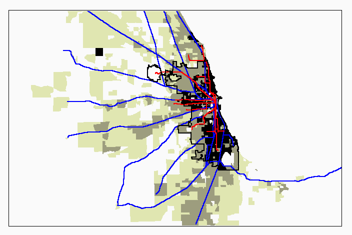
[Chicago GIS data]. Miscellaneous spatial data files for the Chicago area, kept more or less permanently on the hard disks of the Map Collection's public user workstations. Some of these files come directly from various versions of the TIGER/line Files; others (now mostly superseded) were generated by Map Collection staff and are available for downloading.
China. Guo jia tong ji ju. China 2010 township/county/city population census data with GIS maps. Ann Arbor : China Data center, [2013]. Chinese 2010 census data and boundaty files.
Chishitsu Chosajo (Japan). Geological Map of Japan. 2nd ed. Tsukuba, Japan : Geological Survey of Japan, 1994. A geological map of Japan. (An earlier edition is also available.)
Commission for the Geological Map of the World. Geological map of South America = Mapa geológico de América del Sur = Mapa geológico da América do Sul. [Paris] : CGMW, 2001. Boundary shapefiles.
Digitale Landkarten, Türkei = Digital maps, Turkey. [Stuttgart : GfK, 2011]. Boundary files for Turkey.
Environmental Systems Research Institute. ArcAtlas. Redlands, Calif. : ESRI, 1996. Contains many layers of very generalized data on a world scale, including geology and vegetation data.
Earle, Carville. HUSCO, 1790-1999 : Historical United States Boundary Files. Baton Rouge : Geoscience Publications, 1999. Boundary files.
Environmental Systems Research Institute. Digital Chart of the World for Use with ARC/INFO Software. Redlands, Calif. : ESRI, 1993. Contains a world map at a scale of 1:1,000,000 (roughly equivalent to the Defense Mapping Agency's ONC maps). It includes political boundaries, settlements, transportation infrastructure, hydrography, hypsography (relief), and (in some cases) land use. The best digital spatial data available for much of the world, presented here in a somewhat archaic format.
Environmental Systems Research Institute. ESRI U.S. Streets Database. Redlands, Calif. : ESRI, 1997. U.S. streets. Runs under ArcView.
Euratlas-Nüssli (Firm). Georeferenced historical vector data for Europe. Yverdon-les-Bains : Euratlas-Nussli, 2010. Political boundaries in Europe for years divisible by 100 from"0" to 1900.
Geological Survey of Canada. Geological map of Canada. Ottawa : Geological Survey, 1997.
Geological Survey (U.S). Conterminous U.S. Land Cover Characteristics Data Set. Reston, Va. : USGS, 1995. Land-cover data of various sorts in one-kilometer squares.
Geological Survey (U.S.). Geology of the Conterminous U.S. at 1;2,500,000 Scale. Reston, Va. : USGS, 1998. A digital version of the 1974 geology map of the United States. .
Geological Survey (U.S). Maps showing Geology, Oil and Gas Fields, and Geological Provinces of Africa. Denver : USGS, 1997.
Geological Survey (U.S). Maps showing Geology, Oil and Gas Fields, and Geological Provinces of South America. Denver : USGS, 1999.
Geological Survey (U.S). Maps showing Geology, Oil and Gas Fields, and Geological Provinces of South Asia. Denver : USGS, 1999.
Geological Survey (U.S). Maps showing Geology, Oil and Gas Fields, and Geological Provinces of the Arabian Peninsula. Denver : USGS, 1999.
Geological Survey (U.S). Maps showing Geology, Oil and Gas Fields, and Geological Provinces of the Asia Pacific Region. Denver : USGS, 1999.
Geological Survey (U.S). Maps showing Geology, Oil and Gas Fields, and Geological Provinces of the Former Soviet Union. Denver : USGS, 1998.
Geological Survey (U.S.), Preliminary digital geologic map database for Hunduras. [Reston, Va.?] : USGS, [1998].
GeoLytics. Census CD ... E. Brunswick, N.J. : GeoLytics, 1998-. 1970, 1980, 1990, 2000, and 2010 census data and spatial boundary files. Also includes some longitudinal data in consistent boundaries. Much easier to download from than the Census Bureau's Website.
GeoLytics. CensusCD Neighborhood Change Database (NCDB). E. Brunswick, N.J. : GeoLytics, 2003. Tract-level data, 1970-2000, in consistent (2000) boundaries.
Illinois. Dept. of Energy and Natural Resources. Illinois Geographic Information System : Digital Databases of Illinois. Springfield, Ill. : ENR, 1994- Spatial, social, and demographic data for Illinois.
Illinois. Dept. of Natural Resources. Illinois Geographic Information System, May 1996. Springfield, Ill. : ENT, 1996. Political boundaries (including state legislative district boundaries); geology; wetlands; fill sites; and much additional data.
Illinois. Dept. of Resources. Office of Realty and Environmental Planning. Div. of Energy and Environmental Assesssment. Illinois Land Cover : An Atlas on Compact Disc. Springfield, Ill. : Office of Realty and Environmental Assesssment, [1996]. Illinois land use. Contains .gif files and coverages.
Institut géographique national (France). Géofla. [Paris : IGN, 2009] Shapefiles (and GIS files in other formats) for communes, cantons, arrondissements, départements, and régions of France.
Instituto Nacional de Estadística, Geografía e Informática (Mexico). [Áreas geoestadísticas básicas : México]. [Aguascalientes : INEGI, 2011]. Boundary files for 2010 census for a few states.
Instituto Nacional de Estadística, Geografía e Informática (Mexico). [Información vectorial de localidades urbanas : cartografía geoestadística urbana : ciudad de México, Distrito Federal]. [Aguascalientes : INEGI, 2011]. Boundary files for Mexico City in 2010.
Metro Data Resource Center. RLIS Lite : Data for Mapping and Analysis, Portland Region. Portland, Or. : Metro, 1999. Miscellaneous data for Portland area.
ML-InfoMap. IndiaMap 2.1 for ArcView. New Delhi : ML-InfoMap, 1996. District- and state-level maps of India with accompanying data from the 1980s and 1990s.
National Geophysical Data Center. Global Land One-Kilometer Base Elevation. Version 1.0. Boulder : National Geophysical Data Center, 1999. World relief in one-km pixels.
Northeastern Illinois Planning Commission. [1990 Land Use Inventory]. Chicago : NIPC, 1994. Land-use in the 6-county NIPC area.
Northeastern Illinois Planning Commission. Digital Map of the Region : Northeastern Illinois. Chicago : NIPC, 1999. Miscellaneous data for the 6-county NIPC area.
Schruben, Paul G. Geology and Resource Assessment of Costa Rica at 1:500,000 Scale. Reston : U.S.G.S., 1996.
Seamless digital chart of the world. Colorado Springs, CO : Global Mapping International, 2007. Version of the Digital chart of the world.
Statistics South Africa. Census data for 2001, with GIS boundary files. Pretoria : Statistics South Africa, 2004
Statistics South Africa. Census data for 2011, with GIS boundary files. Pretoria : Statistics South Africa, 2015.
United States. National Imagery and Mapping Agency. VMAP1. [S.l.] : GIS Data Dept, 1998? Digital map of about 40% of the world's land area at a nominal scale of ca. 1:250,000. Zipped, VP1 format.
Wessex, Inc. Tiger ... Winnetka, Ill. : Wessex, 1994- Various editions of the Tiger/line files including Zip+4 data.
World language mapping system. Colorado Springs, CO : Global Mapping International, c2005. Language boundaries for the whole world, and a version of the Digital chart of the world.
Zhongguo 2000 xian ji ren kou pu cha zi liao = China 2000 county population census. [China] : All China Marketing Research Co. ; Ann Arbor, MI : Distributed by University of Michigan, China Data Center, 2003. Shapefiles for Chinese counties and provinces, joined to 2000 census data.
Zhongguo wu ci xian ji ren kou pu cha shu ju = Historical county population census data with maps. [Beijing] : All China Marketing Research Co., [2005]. Historical census data at the county level with boundary files.
Printing
Many users print out maps on the Map Collection's HP 7000 printer. This machine prints reasonably high-quality 8-1/2 x 11 inch or 11 x 17 maps.
Downloading Digital Data
Most mapping programs will generate electronic files containing cartographic data. Users are free to download data. The Map Collection has a CD burner, and its computers are equipped with USB ports into which you may plug flash drives. Alternatively, you can e-mail yourself smaller files. Another possibility is exporting your file into a graphics program with more flexible drawing capabilities than the mapping programs. Adobe Photoshop is available at the Map Collection. Note that not all mapping programs generate the same types of export files and that drawing programs vary in their ability to deal with files of different types.

