Introduction
The University of Chicago Map Collection: A Brief Guide
The University of Chicago Map Collection is one of the largest university map libraries in North America. Its 475,000 maps, 10,000 air photos, 2000 books, and hundreds of gigabytes of spatial data constitute a rich source of information for scholars and other users.
The following pages contain a brief guide to the Collection.
Collection Scope
The University of Chicago Map Collection has particularly strong holdings of: (1) topographic maps; (2) urban maps; and (3) thematic maps.
(1) Topographic Maps
More than half the sheets in the Collection are topographic maps: detailed accurate maps of small areas, usually produced by government agencies. They depict relief features, place names, transportation infrastructure, and settlement patterns; even individual houses are included on many series. For the scholar, topographic maps furnish an extraordinary record of both the built and the natural environment. The Collection's holdings cover the entire world but at different scales for different periods and places. For the 19th century, there are fairly good holdings for much of Western Europe and the United States. Coverage was extended to large parts of Latin America, Asia, and Africa during the Collection's first decade, 1929-1939, when about a quarter of its topographic maps were acquired. Another substantial part of the Collection's holdings was obtained as a result of the Army Map Service's depository program, which was particularly active between 1945 and the early 1960s. During the 1980s contemporary topographic sets for much of Latin America as well as for certain other parts of the Third World were purchased. During the 1990s, the Collection began acquiring the newly available topographic maps of the Soviet Union and Eastern Europe, as well as Soviet topographic maps of the Middle East, China, India, and elsewhere. Some effort has also been made to build on existing strengths, and the Collection now has 1:50,000 topographic coverage for most of Western Europe, Southern Canada, Mexico, interior India, and elsewhere, and 1:25,000 (or 1:24,000) coverage for most of the United States, Britain, France, Germany, and a few other countries.
(2) Urban Maps
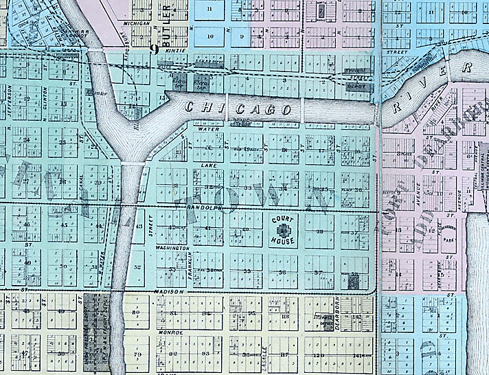
Urban studies have always been a research concern at the University of Chicago, and the Map Collection has supported such research by acquiring urban maps from all periods for all parts of the world. Its holdings of 18th-, 19th-, and early 20th-century maps of European and American cities are particularly noteworthy. Recently, the historical urban-map collection has been enriched considerably by the systematic acquisition of facsimile sets of early maps of European cities and Soviet military urban maps of cities all over the world. In addition to historical maps, the Collection holds contemporary maps of cities and towns in all countries, including numerous thematic maps (e.g., planning maps and transit maps). Its Chicago collection is respectable.
(3) Thematic Maps
Any phenomenon that is not spread uniformly over the surface of the earth is mappable. Maps focusing on the distribution of features of a particular sort are generally known as thematic maps. The Collection holds thematic maps of all types. Perhaps a third are geology maps. Most continents, countries, and states are covered by at least small-scale maps. The Crerar legacy includes hundreds of 19th-century geology and mining maps. These will probably have little interest for modern geophysicists but furnish an extraordinary record of the history of geological thought. There are also additional thematic maps focusing on almost every other imaginable subject, e.g., cultural and economic geography, climatology, property ownership, and so on.
(4) Other Areas of Strength
The Collection has several additional areas of particular strength. For example, it probably has the most complete collection of Survey of India maps in North America. Its holdings of 18th-century maps of Germany are also quite good. It maintains an excellent collection of nautical charts, including several generations of U.S. charts, a large number of British Admiralty and Dépôt des cartes et plans de la marine charts, as well as contemporary or recent series from Canada, India, and Indonesia. Finally, as a depository of U.S. government maps, it has excellent coverage of national parks, forests and, other recreation areas.
Cataloging
The Map Collection's sheet map holdings are now mostly cataloged. As of the spring of 2015, more than 98% of the titles in the Collection were fully cataloged. Records for the Collection's many large sets typically do not contain sheet-level holding information.
Digital Data
Cartographic information has more and more come to be available as digital data. The Map Collection has been acquiring digital cartographic data since 1992. In addition to data, it holds software packages--including ArcGIS 10.3--that can be used to turn data into maps. It also has database management programs that can be used to manipulate data. In addition, the Collection also holds numerous stand-alone mapping packages that contain both data and software. It also has a printer for printing maps and a scanner for digitizing them. Cartographic Information in Digital Form at the University of Chicago Map Collection describes these resources in more detail.
Books
The Collection houses about a thousand atlases, including most major world, national, provincial and urban atlases as well as numerous thematic atlases. These "atlases" include an increasing number of bound sets of facsimile maps: such publications enable the user to fill the major gaps that are inevitable in any one collection. In addition, there are approximately five hundred reference books available, including most of the standard cartobibliographies. Finally, a modest travel collection is maintained. This contains both classics (e.g., WPA guides, Baedekers) and a representative selection of contemporary guidebooks.
Collection Development
The Collection has been adding several thousand new sheet maps, several dozen books, and a substantial amount of digital data every year. A collection-development policy statement is available.
Using the Map Collection
The Map Collection is located in room 370 of the Joseph Regenstein Library, 1100 E. 57th Street, Chicago 60637. Hours are Monday to Friday, 12 to 5. Telephone: (773) 702-8761. E-mail: wintersc@uchicago.edu.
Many users want to copy maps. The Map Collection has a Contex HD Ultra i4250s scanner that permits the scanning of maps up to 42 inches wide. It also has an Epson Expression 10000 XL scanner that allows users to scan maps (and other objects) up to approximately 11 x 17 inches in size. The scans can be saved as files or printed on an 11 x 17 inch color printer. It is also possible to bring one's own camera. Map Collection patrons also have access to the Library's regular photocopiers.
Cartographic Materials Elsewhere at the University of Chicago Library
(1) Atlases
The Map Collection houses only a small proportion of the atlases at the University of Chicago Library. Most reading rooms have their own small atlas collections. Thus, for example, several business atlases are kept in the main reference collection; some thematic atlases are housed in the Second- and Third-Floor Reading Room collection; and some atlases of the Middle East, South Asia, the Far East and the Classical World are held in the Fifth-Floor Reading Room. In addition, Crerar Library holds many science atlases. Hundreds of additional atlases are kept in the Regenstein stacks and (especially) in Mansueto, including most of the Library's U.S. and Canadian county atlases. Most early atlases are kept in Special Collections.
(2) Maps in Books and Journals
As in any research library, most maps are found neither in the form of sheet maps nor in atlases but in scholarly books and journals, either as illustrative material in texts or else bound in or kept in pockets. Locating these maps is not easy, but the Map Collection holds several standard bibliographies, and Map Collection staff can offer suggestions.
Cartographic Materials at Other Institutions
No map library somes close to having "everything." The nature of map publishing and collection has been such that all map collections have major gaps. Many scholarly users will wish to consult materials at other institutions. A good place to begin a search is OCLC's WorldCat, which now has more than 4,600,000 map records, all with holdings information. Note, however, that many map libraries have not created electronic records for all their holdings. The Map Collection has numerous cartobibliographies and paper catalogs that can help. In Chicago, the Newberry Library (60 W. Walton St., (312) 943-9090) has an extraordinary collection of historical maps. Other local institutions with important map holdings are the Chicago History Museum, the University of Illinois at Chicago, and Northwestern University. Historical and other maps can now be found by the thousand on the Internet.
-------------------------------------------------------
The above orientation to the collection was written by Christopher Winters, the former Bibliographer or Anthropology, Geography, and Maps, who has recently retired.
As of April, 2016, all inquiries to the Map Collection should be sent to:
Sam Brown
Interim Map Collection manager and GIS assistant
JRL 370, (773) 702-8761
e-mail: sbb@uchicago.edu

