19th-Century Maps of the Middle East, North Africa, and Central Asia
19th-Century Maps of the Middle East, North Africa, and Central Asia
This page provides access to scans of some of the 19th-century maps of the Middle East, North Africa, and Central Asia that are held at the University of Chicago Library's Map Collection.
Most of these maps were published in Western Europe, and nearly all the others were published in Russia or in the United States. The maps are products of--or were designed to support--the major European and Russian activities in the region: exploration, scientific research, resource exploitation, conquest, and administration.
Several genres are represented. Some of the maps of Algeria and Central Asia are military topographic maps that were surely compiled at the behest of colonial administrations. Other maps are nautical charts, maps designed to facilitate navigation. A few of the maps are "theatre of war" maps that were published by commercial firms and sold to members of the public who wanted to follow wars that for the first time were being reported in daily newspapers on the basis of telegraph dispatches. Many of the maps are products of European scholarly interest. Some show the paths of recent journeys of exploration. Others are "synthetic" maps that show the results of many decades of research. More than half of the scholarly maps are offprints from then-new scholarly journals like Petermanns Geographische Mitt(h)eilungen and the Bulletin de la Société de géographie.
Most of the maps of Algeria and many of the other maps as well are from the collection that was assembled by the French geographer Emile Levasseur (1828-1911) and bought in 1914 by the old John Crerar Library. The maps were acquired in 1930-1931 by the University of Chicago Library. This was in part a working collection, used by Levasseur and his colleagues for the production of new cartographic materials. Several of the maps have penciled grids that were used before cheap xerography (and of course long before GIS) for the transfer of cartographic information from an existing map onto a new one.
The maps make up approximately a quarter of the Map Collection’s 19th-century Middle East holdings. We have tended to choose maps that are not widely held and that are not easily available for download from the Internet. Call-number-browse and subject searches in the Library's catalog should help you identify other available sheets.
The maps were scanned on the Map Collection's HD Ultra i4250s Contex scanner at 400 dpi using NextImage software.
You can access the files in two different ways:
[1] Click on the thumbnails below, which are listed alphabetically by root call number, then by date (ascending). The root call numbers are based on geography and, for the Middle East and vicinity, move from north to south, from Central Asia, to the Middle East proper, then to North Africa. Root call numbers ending in 0 or 5 are for general maps; those ending in 1 are for thematic maps; those ending in 2 and 3 are for maps of regions; and those ending in 4 are for city maps.
[2] You can also access the maps through the spatial index just below. The rectangles show the approximate extent of each map. Click on the rectangle borders to be taken to the maps. You will need to zoom in to access the maps of small areas.
Whether you access the maps from thumbnails or from the spatial index, you will be taken to a page that lets you choose between access via Zoomify and access via Luna. Zoomify is perhaps best if you want to examine the maps closely. It breaks the original tiff files into tiny jpegs, so you can zoom in and out and move around quickly and efficiently. Zoomify requires Flash and so won't work on many mobile phones. Luna, in contrast, allows printing--and download--of jpeg versions of the files (click "Export"). Luna should work fine on mobile phones (although a bigger screen is very advantageous for map viewing!).
If you need the original tiff files, e-mail from the "Questions about this page?" button below.
Downloaded files are freely available for personal or scholarly use. If you use the images in a publication, we expect that you will mention that the original maps--and the files--are from the University of Chicago Library's Map Collection.
Many people contributed to the compilation of this Web page. Bobby Butler and Michael Weinrib of the Map Collection did virtually all the scanning, and Bobby did most of the necessary file cleanup. Andrew Chuang of the Map Collection did the bulk of the very large amount of work required to get the links in order. Map Collection assistant Sam Brown is entirely responsible for the spatial index. Bridget Madden of the University of Chicago's Visual Resources Center and Charles Blair of the Library's Digital Library Development Center developed a protocol in 2015 that allows access via Luna, and Bridget moved all the files into Luna, a sometimes complicated process. In addition, John Jung of the Library's Digital Library Development Center helped with several programming issues.
Comments are welcome.
--CW, February 2016
| + ... Central Asia |
| Kazakhstan/Kyrgyzstan |
| + Middle East (Asian Middle East) |
| Jordan River Valley |
| Turkey / Former Ottoman Empire |
| Syria and Lebanon |
| Palestine |
| Arabia |
| Iraq |
| Iran |
| Azerbaijan |
| Afghanistan |
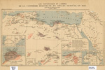
| + North Africa |
| Egypt |
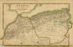
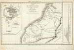
| Morocco |
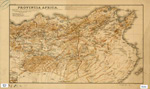
| Algeria |
| Tunisia |
| Libya |
| Image | Root Call Number | Title Information | Subject Headings | Description |
|---|---|---|---|---|
| Central Asia (see also Afghanistan at G7630) | ||||
 |
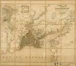
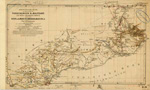
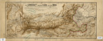
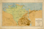
G7210 | Карта областей Уральской, Тургайской, Акмолинской, Семипалатинской, съ Туркестанскимъ генералъ-губернаторствомъ [Karta oblasteĭ Uralʹskoĭ, Turgaĭskoĭ, Akmolinskoĭ, Semipalatinskoĭ, s Turkestanskim general-gubernatorstvom.] | Asia, Central--Maps. | Scale 1:4,200,000. [Saint Petersburg] : Картографическое заведеніе А. Ильина [Kartograficheskoe zavedenīe A. Ilʹina], [1871?]. 1 map : hand colored ; 60 x 78 cm, on sheet 69 x 88 cm. |
 |
G7210 | Карта Туркестанскаго генералъ губернаторства / составлена при Азіятской части Главнаго штаба Корпуса военныхъ топографовъ стабсъ капитаномъ Люсилинымъ, подъ руководствомъ Генеральнаго штаба подполковника Нарбутъ [Karta Turkestanskago general gubernatorstva / sostavlena pri Azīi͡atskoĭ chasti Glavnago shtaba Korpusa voennykh topografov stabs kapitanom Li͡usilinym, pod rukovodstvom Generalʹnago shtaba podpolkovnika Narbut]. | Asia, Central--Maps. | Scale 1:2,100,000. 50 versts = 1 in. [Saint Petersburg] : Изданіе Картографическаго заведенія А. Ильина [Izdanīe Kartograficheskago zavedenīi͡a A. Ilʹina], 1871. 1 map : hand colored ; 70 x 112 cm, on sheet 78 x 117 cm. |
  |
G7210 | The Russian official map of Central Asia : compiled in accordance with the discoveries and surveys of Russian staff officers up to the close of the year 1877 / drawn, printed & published by W.H. Allen & Co. | Asia, Central--Maps. | Scale approximately 1:6,400,000. London : W.H. Allen & Co., [1879]. 1 map on 2 sheets : color ; 68 x 96 cm, sheets 75 x 55 cm. |
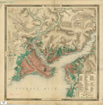
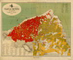
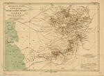
| G7211 | Геологическая карта Туркестанскаго края / составленная въ 1881 году горными инженерами Г.Д. Романовскимъ и И.В. Мушкетовымъ, преимущественно на основаніи личныхъ наблюденій производившихся съ 1874 по 1880 года [Geologicheskai͡a karta Turkestanskago krai͡a / sostavlennai͡a v 1881 godu gornymi inzhenerami G.D. Romanovskim i I.V. Mushketovym, preimushchestvenno na osnovanīi lichnykh nabli͡udenīĭ proizvodivshikhsi͡a s 1874 po 1880 goda]. | Geology--Asia, Central--Maps. Central Asia--Maps. |
Scale approximately 1:1,250,000. [Saint Petersburg] : Картографич. заведеніе Военно-топографическаго отдѣла главн. штаба [Kartografich. zavedenīe Voenno-topograficheskago otdi͡ela glavn. shtaba ], 1884. 1 map on 6 sheets : color ; sheets 70 x 63 cm. | |
 |
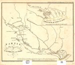
G7220 | Carte des régions Sémiretschinsk et Transilienne dans l'Asie centrale : d'après les dernièrs travaux de M.Mrs. Séménof, Véniukof et Golubef / reproduite d'après l'original russe (1861) par V.A. Malte-Brun ; gravé par Erhard. | Kazakhstan--Maps. Kyrgyzstan--Maps. |
Scale 1:2,080,000. [Paris] : Société de géographie, [1864]. 1 map ; 39 x 34 cm. |
 |
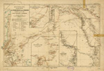
G7405 | Central Asia / by Keith Johnston. | Asia, Central--Maps. | Scale 1:4,979,779. Edinburgh : W. & A.K. Johnston, [1881]. 1 map : color ; 43 x 56 cm. |
| Middle East/Asian Middle East | ||||
 |
G7420 | Uebersichtskarte der vordern Morgenlaender. | Middle East--Maps. | Scale approximately 1:7,000,000. Bâle : Lith. H. Bienz fils, [182-?]. 1 map ; 28 x 39 cm. |
 |
G7420 | Vorder-Asien / Terrain gestochen von C. Seitz, 1855 ; Situation und Schrift gestochen von C.F. Wolff. | Middle East--Maps. | Scale 1:5,000,000. Berlin : Bei Dietrich Reimer, [1860]. 1 map : color ; 42 x 54 cm. |
 |
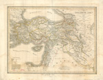
G7420 | Klein-Asien & Syrien : nebst den westlichen Theilen von Armenien, Kurdistan & Mesopotamien / von A. Petermann ; gest. v. F. Eulenstein u. C. Jungmann. | Middle East--Maps. | Scale 1:3,700,000. Gotha : Justus Perthes, 1873. 1 map : color ; 34 x 42 cm. |
 |
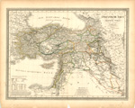
G7420 | Asie occidentale / par le colonel Niox. | Middle East--Maps. | Scale 1:8,000,000. Paris : Ch. Delagrave, [between 1890 and 1892]. 1 map : color ; 33 x 51 cm. |
 |
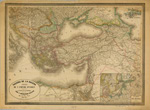
G7420 | Vorder-Asien / gez. v. H. Kiepert ; lith. v. J. Sulzer u. L. Kraatz. | Middle East--Maps. | Scale 1:8,000,000. Berlin : Geographische Verlagshandlung von Dietrich Reimer, 1895. 1 map : color ; 42 x 54 cm, on sheet 51 x 62 cm. |
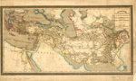 |
G7421 | Regnum Alexandri Magni, regis Macedonum et eius expeditionum cursus / delineanda curavit Car. Timoth. Zumptius. | Alexander, the Great, 356 B.C.-323 B.C.--Campaigns--Maps. Middle East--History--To 622--Maps. |
Scale approximately 1:12,000,000. Braunschweig : Verlag von Fr. Vieweg & Sohn, [1849?]. 1 map : hand colored ; 22 x 44 cm, on sheet 28 x 50 cm. |
 |
G7422.J6 | Itinéraire du cours du Jourdain / par M. J. de Bertou ; gravé par Ambroise Tardieu. | Jordan River Valley--Maps. | Scale approximately 1:750,000. [Paris] : [Société de géographie], 1839. 1 map : hand colored ; 30 x 13 cm, on sheet 37 x 20 cm. |
 |
G7430 | Das Osmanische Asien / entworfen von C.F. Weiland. | Turkey--Maps. Middle East--Maps. |
Scale approximately 1:4,000,000. Weimar : Im Verlage des Geograph. Instituts, 1826. 1 map : hand colored ; 42 x 57 cm, on sheet 54 x 70 cm. |
 |
G7430 | Das Osmanische Asien, oder, die Asiatische Türkey / entworfen und gezeichnet von C.F. Weiland. | Turkey--Maps. Middle East--Maps. Turkey--Administrative and political divisions--Maps. |
Scale 1:3,640,000. Weimar : Im Verlage des Geograph. Instituts, 1844. 1 map : hand colored ; 51 x 66 cm. |
 |
G7430 | Théâtre de la guerre : carte de l'empire Ottoman, comprenant les environs de la Mer baltique. | Turkey--Maps. Europe, Eastern--Maps. |
Scale approximately 1:4,500,000. Paris : Publiée par J. Andriveau-Goujon, 1854. 1 map : color ; 53 x 75 cm, on sheet 61 x 83 cm. |
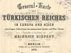 |
G7430 | General Karte des Türkischen Reiches in Europa und Asien nebst Ungarn, Südrussland, den kaukasischen Ländern und West-Persien / entworten u. bearbeitet von Heinrich Kiepert. | Turkey--Maps. Thrace, Eastern (Turkey)--Maps. Balkan Peninsula--Maps. |
Scale 1:3,000,000. Berlin : Verlag von Dietrich Reimer, 1855. 1 map on 4 sheets : color ; 88 x 123 cm, sheets 43 x 59 cm. |
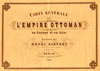 |
G7430 | Carte générale de l'Empire Ottoman en Europe et en Asie / dressée par Henri Kiepert. | Turkey--Maps. Middle East--Maps. |
Scale 1:3,000,000. Berlin : D. Reimer, 1867. 1 map on 4 sheets : color ; 102 x 134 cm, sheets 51 x 67 cm. |
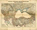 |
G7430 | Russisch-türkischer Kriegsschauplatz, 1877 / von A. Petermann. | Turkey--Maps. | Scale 1:3,700,000. Gotha : Justus Perthes, 1877. 1 map : color ; 44 x 62 cm. |
 |
G7430 | Stanford's map of Turkey in Europe and her tributary states, together with such parts of Russia, Austria, Turkey in Asia, & Persia : coloured to shew the new boundaries as settled by the Treaty of Berlin. | Treaty of Berlin (1878)--Maps. Turkey--Maps. Balkan Peninsula--Maps. Maps. |
Scale approximately 1:5,069,000. London : Edward Stanford, [1878]. 1 map : color ; 72 x 105 cm. |
 |
G7430 | Die politischen Verhältnisse und Staaten-Grenzen von Südost-Europa und Vorder-Asien nach dem Berliner Vertrage 13. Juni-13. Juli 1878 / von A. Petermann. | Turkey--Maps. Turkey--History--1829-1878--Maps. Balkan Peninsula--Maps. |
Scale 1:7,500,000. Gotha : Justus Perthes, 1878. 1 map : color ; 26 x 43 cm. |
 |
G7430 | Орографическая карта азіятской Турціи / составлена по новѣйшимъ свѣденіямъ въ Военно-топограф. отдѣлѣ Кавказ. военнаго округа [Orograficheskai͡a karta azīi͡atskoĭ Turt͡sīi / sostavlena po novi͡eĭshim svi͡edenīi͡am v Voenno-topograf. otdi͡eli͡e Kavkaz. voennago okruga]. | Turkey--Maps. | Scale 1:2,100,000. Г. Тифлисъ [G. Tiflis] : Литографирована в Военно-топограф. отдѣлѣ Кавказ. военнаго округа [Litografirovana v Voenno-topograf. otdi͡eli͡e Kavkaz. voennago okruga], 1882. 1 map : color ; 64 x 100 cm, on sheet 73 x 104 cm. |
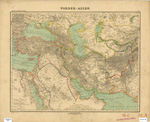
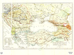
| G7430 | Nouvelle carte générale des provinces asiatiques de l'Empire ottoman (sans l'Arabie) / dressée par Henri Kiepert, Berlin 1883 ; autographié par W. Droysen. | Turkey--Maps. Turkey--Administrative and political divisions--Maps. Middle East--Maps. |
Scale 1:1,500,000. Berlin : Dietrich Reimer, 1884. 1 map on 6 sheets : color ; 96 x 155 cm, sheets 54 x 61 cm. | |
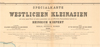 |
G7430 | Specialkarte vom westlichen Kleinasien : nach seinen eigenen Reisen und anderen grösstenteils noch unveröffentlichten Routenaufnahmen bearbeitet / von Heinrich Kiepert = Carte de la partie occidentale de l 'Asie mineure / dressée par Henri Kiepert d'après ses propres observations et d'autres levées pour la plupart inédites = Map of the western part of Asia Minor / drawn by Henry Kiepert from his own researches and other surveys mostly unpublished. | Turkey--Maps. | Scale 1:250,000. Berlin : Verlag von Dietrich Reimer, 1890-1892. 16 maps : color ; each 50 x 61 cm or less. |
 |
G7431 | Map to illustrate Professor Max Müller's "Suggestions" for the assistance of officers in learning the languages of the seat of war in the East / drawn by Augustus Petermann, 1854 ; lith. by A. Petermann. | Turkey--Languages--Maps. Balkan Peninsula--Languages--Maps. |
Scale approximately 1:6,000,000. [London] : [Williams and Norgate], [1855]. 1 map : color ; 32 x 46 cm. |
 |
G7431 | Verteilung der armenischen Bevölkerung in Türkisch-Armenien, Kurdistan, u. Transkaukasien : nach Cuinet, Selenoy, und v. Seydlitz / entworfen von A. Supan ; B.H. del. | Armenians--Turkey--Maps. Armenians--Caucasus--Maps. Ethnology--Turkey--Maps. Ethnology--Caucasus--Maps. |
Scale 1:3,700,000. Gotha : Justus Perthes, 1896. 1 map : color ; 21 x 25 cm. |
 |
G7431 | Carte de la frontière russo turque dans l'Asie mineure. | Turkey--Boundaries--Georgia (Republic)--Maps. Georgia (Republic)--Boundaries--Turkey--Maps. Turkey--Boundaries--Armenia (Republic)--Maps. Armenia (Republic)--Boundaries--Turkey--Maps. |
Scale 1:840,000. Vienne : Artaria & compie, 1877. 1 map : color ; 39 x 61 cm. |
 |
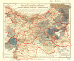
G7431 | Aperçu général de la division administrative des provinces asiatiques de l'Empire Ottoman : selon le dénombrement officiel contenu dans le Sâlnâmé pour l'année 1300 de l'hégire (1883-84) / arrangé approximativement par H. Kiepert ; autographié par C. Ohmann. | Turkey--Administrative and political divisions--Maps. Turkey--History--Ottoman Empire, 1288-1918--Maps. Middle East--Maps. |
Scale not given. Berlin : D. Reimer, 1884. 1 map : color ; 32 x 54 cm. |
 |
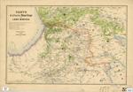
G7431 | Asiatische Türkei / gez. v. H. Kiepert ; lith. v. Leop. Kraatz u. J. Sulzer. | Turkey--Administrative and political divisions--Maps. Middle East--Maps. |
Scale 1:4,000,000. Berlin : Dietrich Reimer, 1895. 1 map : color ; 42 x 54 cm, on sheet 52 x 64 cm. |
 |
G7432.D3 | Prospecht der Europaisen und Asiatise Küste und der beÿ der auch solche gelegen Dardanelle u. s. w. | Dardanelles Strait (Turkey)--Aerial views. | Not drawn to scale. [Germany?] : [publisher not identified], [182-?]. 3 views on 1 sheet ; sheet 21 x 35 cm. |
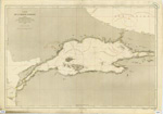 |
G7432.M3 | Carte de la Mer de Marmara / publiée par ordre de l'Empereur au Dépôt des cartes et plans de la marine en 1861 ; gravé par Chassant ; ecrit par A. Blanchard. | Nautical charts--Turkey--Marmara, Sea of. Nautical charts. Maps. |
Scale approximately 1:1,750,000. [Paris] : Dépôt des cartes et plans de la marine, [1870]. 1 map : hand colored ; 60 x 89 cm. |
 |
G7432.T3 | Karte von den Nordabbäugeu des Bulgar (Taurus) u. Allah-Dagh (Anti-Taurus) zwischen Eregli, Nihde, und dem Kulek Bogas (Pilae Ciliciae) / nach der Aufnahme des Major Fischer. | Taurus Mountains (Turkey)--Maps. | Scale 1:150,000 Berlin : Bei S. Schropp & Co., [1854?]. 1 map ; 47 x 84 cm, on sheet 62 x 88 cm. |
  |
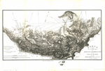
G7433.A7 | Itinerar-Aufnahmen im Flussgebiet des unteren Kyzyk-Yrmak (Halys) / ausgeführt im Juli-September 1893 von Maercker, Pr.-Lieutenant ... , Kannenberg, Pr.-Lieutenant ... , und im Juli-September 1894 von Schaeffer, Pr. Lieutenant ... , unter Benutzung der 1895 veröffentlichten Itinerar-Aufnahmen der Pr. Lieutenants v. Prittwitz u. Gaffron und v. Flottwell. | Ankara İli (Turkey)--Maps. Çankırı İli (Turkey)--Maps. Çorum İli (Turkey)--Maps. Sinop İli (Turkey)--Maps. Samsun İli (Turkey)--Maps. Kizil River Valley (Turkey)--Maps. |
Scale 1:250,000. Berlin : Geogr.-lith. Anst. u. Steindr. v. C.L. Keller, 1899. 2 maps : color ; 61 x 92 cm and 50 x 72 cm. |
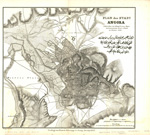 |
G7434.A6 | Plan der Stadt Angora / aufgenommen vom Königl. Preuss. Major im Generalstabe Freih. v. Vincke im Januar 1839. | Ankara (Turkey)--Maps. | Scale 1:12,500. Berlin : Verlag von Simon Schropp et Comp., 1854. 1 map ; 35 x 39 cm, on sheet 40 x 45 cm. |
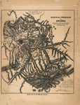 |
G7434.A6 | Karte der Umgegend von Angora / aufgenommen vom Königl. Preuss. Major im Generalstabe Freih. v. Vincke im Frühjahr 1839 ; Metallographie v. C. Brügner. | Ankara (Turkey)--Maps. | Scale 1:73,000. Berlin : Bei S. Schropp & Comp., 1846. 1 map ; 38 x 33 cm, on sheet 49 x 37 cm. |
 |
G7434.I8 | Constantinople / A.H. Dufour, direx. ; Gavard, sculp. ; Bénard, scrip. | Istanbul (Turkey)--Maps. | Scale approximately 1:28,000. Paris : Jules Renouard, [184-?]. 1 map ; 20 x 25 cm, on sheet 23 x 28 cm. |
 |
G7434.I8 | Plan de Constantinople et de ses faubourgs et d'une partie du Bosphore : d'après Kauffer, Lechevalier, Joseph de Hammer, et le Baron de Moltke / dressé par A.H. Dufour ; gravé sur acier par Edd. Blondeau ; écrit par Langevin. | Istanbul (Turkey)--Maps. | Scale approximately 1:30,000. [Paris] : Librairie de l'Hachette, [185-?]. 1 map ; 45 x 56 cm, on sheet 50 x 58 cm. |
 |
G7434.I8 | Plan von Constantinopel. | Istanbul (Turkey)--Maps. Ethnology--Turkey--Istanbul--Maps. |
Scale 1:28,800. [Vienna?] : [Artaria?], [187-?]. 1 map : color ; 50 x 50 cm. |
 |
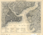
G7434.I8 | Plan von Constantinopel mit den Vorstädten, dem Hafen, und einem Theile des Bosporus / aufgenommen und gezeichnet von C. Stolpe nach den zeitherigen Veränderungen berichtigt bis zum Jahre 1882 = Plan de Constantinople avec ses faubourgs, le port et une partie du Bosphore / levé et dessiné par C. Stolpe, verifié d'après les changements les plus récents jusqu'en 1882. | Istanbul (Turkey)--Maps. Ethnology--Turkey--Istanbul--Maps. |
Scale 1:15,000. Constantinopel : Verlag von Lorentz & Keil, 1882. 1 map : color ; 69 x 52 cm, on sheet 72 x 59 cm. |
 |
G7434.I9 | Plan de Smyrne / levé et dressé par Lamec Saad. | İzmir (Turkey)--Maps. | Scale 1:5,000. Leipzic : J.C. Hinrichs, 1876. 1 map : color ; 72 x 94 cm, on sheet 82 x 101 cm. |
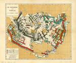 |
G7434.T7 | Die Ausgrabung von Troja / aufg. von W. Dörpfeld und W. Wilberg. | Troy (Extinct city)--Maps. Excavations (Archaeology)--Turkey--Troy (Extinct city)--Maps. |
Scale 1:5,000. [Leipzig] : [F.A. Brockhaus], [1894] 1 map : color ; 35 x 42 cm. |
 |
G7460 | Carte de la Montagne des Ansariés et du Pachalik d'Alep / par E.G. Rey. | Syria--Maps. Lebanon--Maps. Hatay İli (Turkey)--Maps. |
Scale 1:500,000. [Paris] : Société de géographie, 1873. 1 map : color ; 65 x 57 cm. |
 |
G7461 | Reconnaissance de la montagne des Ansariés et d'une partie du Pachalik d'Alep / exécutée par E.G. Rey en 1864-1865 ; gravé par Erhard. | Syria--Discovery and exploration--Maps. | Scale 1:500,000. [Paris] : [Société de géographie], 1866. 1 map ; 44 x 35 cm. |
 |
G7470 | Carte des pays explorés par la Mission de Phénicie / dressée au Depôt de la guerre d'après les travaux de M.Mrs Gélis, Nau de Champlouis, et Béguin du Corps d'Etat-Major ; gravé par Erhard. | Lebanon--Maps. | Scale 1:500,000. [Paris] : Depôt de la guerre, [1864?]. 1 map : color ; 45 x 30 cm. |
 |
G7474.T9 | Plan de Tyr / par Poulain de Bossay ; gravé chez Erhard. | Tyre (Lebanon)--Maps. Tyre Region (Lebanon)--Maps. |
Scale approximately 1:11,400. Scale approximately 1:55,500. [Paris] : Société de géographie, 1861. 2 maps on 1 sheet ; 19 x 15 cm and 19 x 10 cm, sheet 23 x 29 cm. |
  |
G7480 | Carte de la Terre sainte / déssinée par A. de Mandrot, colonel à l'Etat major fédéral suisse, d'après Van der Welde, Berghaus, Baumer, &a. | Bible--Geography--Maps. Middle East--Maps. |
Scale 1:315,000. Neuchâtel : Auto. Litho. de H. Furrer, 1872. 1 map on 2 sheets : color ; 124 x 77 cm, sheets 68 x 89 cm. |
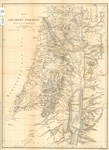 |
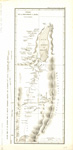
G7500 | Map of Southern Palestine : chiefly from the routes of E. Robinson & others / drawn by H. Kiepert. | Palestine--Maps. Robinson, Edward, 1794-1863--Travel--Maps. |
Scale 1:400,000. Boston : Published by Crocker & Brewster, 1856. 1 map : color ; 54 x 40 cm. |
 |
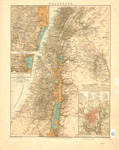
G7500 | Palaestina / ex veteris aevi monumentis ac recentiorum observationibus illustravit Marinus Didericus de Bruyn ; Georgius Mayr sculpsit. | Palestine--Maps. | Scale 1:420,000. Traject[um] ad Rhenum : Apud Kemink & filium, 1874. 1 map ; 74 x 65 cm, on sheet 89 x 73 cm. |
 |
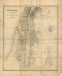
G7500 | Palästina / bearbeitet von Hans Fischer & H. Guthe. | Palestine--Maps. | Scale 1:700,000. Leipzig : Verlag der Geogr. Anstalt Wagner & Debes, [189-?]. 1 map : color ; 54 x 40 cm. |
 |
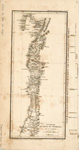
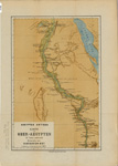
G7502.N4 | Itinéraire de la Mer morte à Akaba / par M.J. de Bertou. | Bertou, Jules, comte de.--Travel--Maps. Negev (Israel)--Discovery and exploration--Maps. |
Scale approximately 1:750,000. [Paris] : [Société de géographie], [1839]. 1 map ; 41 x 15 cm, on sheet 47 x 23 cm. |
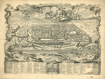 |
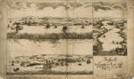
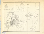
G7504.J4 | Neuer und wahrer Abriss der Stadt Ierusalem / verlegt von Joseph Eder. | Jerusalem--Aerial views. | Not drawn to scale. Wien : Joseph Eder, [approximately 1800]. 1 view ; 39 x 54 cm, on sheet 44 x 58 cm. |
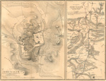 |
G7504.J4 | Plan of Jerusalem / originally sketched from Sieber and Catherwood ; corrected by the measurements of Robinson and Smith. | Jerusalem--Maps. | Scale 1:10,000. Boston : Crocker & Brewster, [1841?]. 1 map ; 32 x 26 cm, on sheet 33 x 43 cm. |
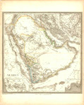 |
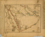
G7520 | Arabien : nach C.F. Weiland's Entwurf / völlig umgearbeitet von H. Kiepert mit Benutzung von C. Ritter's Erdkunde von Arabien und der dazu gehörigen Originalkarten und Berichtigung der Orthographie. | Arabian Peninsula--Maps. Mecca Region (Saudi Arabia)--Maps. Aden Region (Yemen)--Maps. Sinai Region (Egypt)--Maps. |
Scale approximately 1:5,500,000. Weimar : Verlag des Geograph. Instituts, 1848. 1 map : color ; 51 x 51 cm. |
 |
G7520 | Arabien : zu C. Ritter's Erdkunde Buch III, West-Asien, Theil XII u. XIII / bearbeitet von Heinrich Kiepert. Neue berichtigte Ausg. / die Orthographie revidirt von Th. Nöldeke. | Arabian Peninsula--Maps. | Scale 1:6,000,000. Berlin : D. Reimer, 1867. 1 map : color ; 38 x 49 cm. |
 |
G7520 | A map of north western Arabia and Nejd / by Charles M. Doughty. | Arabian Peninsula--Maps. | Scale 1:2,027,520. [London] : Stanford's Geographic Establishment, 1884. 1 map : color ; 45 x 51 cm. |
 |
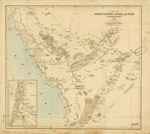
G7531 | Itinéraires dans l'Arabie septentrionale = صورة بلاد العرب الشمالية [Ṣūrat bilād al-ʻArab al-shamāl̄īyah] / par Ch. Huber, chargé d'une mission scientifique par le Ministre de l'instruction publique, 1879-1881 ; dessiné par J. Hansen ; gravé par Erhard. | Saudi Arabia--Discovery and exploration--Maps. Iraq--Discovery and exploration--Maps. Huber, Charles, 1837-1884--Travel--Maps. |
Scale 1:2,500,000. [Paris] : [Société de géographie], 1884. 1 map : color ; 45 x 49 cm. |
 |
G7540 | Itinéraire d'un voyage dans le Yemen / par Joseph Halévy ; gravé par Erhard. | Halévy, J. (Joseph), 1827-1917--Travel--Maps. Yemen, North--Maps. Yemen, North--Discovery and exploration--Maps. |
Scale [ca. 1:1,600,000]. [Paris] : [Société de géographie], [1873].1 map : color ; 35 x 31 cm, on sheet 49 x 39 cm. |
 |
G7540 | Originalkarte zur Übersicht der Forschungen H. v. Maltzan's in Süd-Arabien, 1870/71, sowie der Reisen von A. v. Wrede (1843), Munzinger & Miles (1870) u. A. / von A. Petermann ; bearbeitet v. Fr. Hanemann. | Yemen--Maps. Maltzan, Heinrich, Freiherr von, 1826-1874--Travel--Maps. Wrede, Adolf von, 1807-1863--Travel--Maps. Munzinger, Werner, 1832-1875--Travel--Maps. Miles, S. B. (Samuel Barrett), 1838-1914--Travel--Maps. |
Scale 1:1,500,000. Gotha : Justus Perthes, 1872. 1 map : color ; 28 x 45 cm, on sheet 28 x 47 cm. |
 |
G7540 | Provisorische Skizze eines Teiles von Eduard Glasers Reisen in Jemen, Oktober 1883, März 1884, und Ende April 1885 / von Eduard Glaser ; redig. von B. Hassenstein ; autogr. v. C. Barich. | Glaser, Eduard, 1855-1908--Travel--Maps. Yemen, North--Maps. |
Scale 1:500,000. Gotha : Justus Perthes, 1886. 1 map : color ; 33 x 47 cm. |
 |
G7544.A2 | Côte d'Arabie, Aden et baies adjacentes / ce plan est la reproduction de celui du Comr. Haines de la Marine royale d'Angleterre, levé en 1836, corrigé en 1863, L. Manen, s. ingr. hyde. ; gravé par J. Geisendörfer. | Aden Region (Yemen)--Maps. Nautical charts--Aden, Gulf of. |
Scale approximately 1:75,000. [Paris] : Dépôt des cartes et plans de la marine, [1872?]. 1 map ; 43 x 88 cm, on sheet 66 x 94 cm. |
 |
G7610 | Partie du cours de l'Euphrate et du Tigre / gravé par Hellrigel. | Iraq--Maps. Rivers--Iraq--Maps. |
Scale approximately 1:2,250,000. [Paris] : [Société de géographie], 1838. 1 map : hand colored ; 20 x 25 cm. |
  |
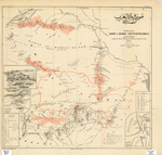
G7610 | Originalkarte der Eufrat- und Tigris-Gebiete, von Alexandretta, der Orontes-Mündung & Tarâbulus am Mittelmeer im Südwesten bis Diarbekr & Bagdad im Norden & Osten / nach den Aufnahmen von Ingenieur Josef Černik's Expedition ; reduzirt nach den meist im Maassstabe von 1:20.000 ausgeführten Original-Aufnahmen ; redigirt von A. Petermann. | Iraq--Maps. | Scale 1:1,100,000. Gotha : Justus Perthes, 1875. 1 map on 2 sheets : color ; sheets 25 x 42 cm. |
 |
G7611 | Routenkarte einer Reise von Damaskus nach Baṛdād : ausgeführt im Jahre 1893 von Dr. Max Freiherrn von Oppenheim / red. v. B. Hassenstein ; aut v. dems. u. C. Schmidt. | Oppenheim, Max, Freiherr von, 1860-1946--Travel--Maps. Iraq--Discovery and exploration--Maps. Syria--Discovery and exploration--Maps. |
Scale 1:1,200,000. Gotha : Justus Perthes, 1896. 1 map : color ; 47 x 75 cm, on sheet 53 x 78 cm. |
 |
G7614.M6 | Plan von Mosull / aufgenommen von v. Moltke. | Mosul (Iraq)--Maps. | Scale approximately 1:42,750. Berlin : Verlag von Simon Schropp & Co., [1841?]. 1 map ; 20 x 24 cm, on sheet 25 x 32 cm. |
   |
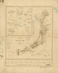
G7614.N4 | Vestiges of Assyria / by Felix Jones ; aided in the field operations by J.M. Hyslop. | Nineveh (Extinct city)--Maps. Calah (Extinct city)--Maps. Mosul (Iraq)--Maps. |
Scales differ. [London?] : John Walker, 1855. 3 maps : color ; 122 x 77 cm each, on sheets 130 x 77 cm. |
 |
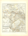
G7620 | Iran und Turan (Persien, Afghanistan, Biludschistan, Turkestan) : eine geographische Skizze / von Dr. Bgs., entworfen 1829 ; gest. v. S. Siebert ; Schrift v. H. Hertzberg. | Iran--Maps. Afghanistan--Maps. Balochistān (Pakistan)--Maps. |
Scale approximately 1:9,400,000. Gotha : Bei Justus Perthes, 1831. 1 map : hand colored ; 30 x 38 cm. |
 |
G7620 | Karte des westlichen Hochlandes von Mittel-Asien, oder die Staaten von Iran und Turan, enthaltend Persien, Afghanistan, Belutschistan, Turkestan, u.s.w. : sammt den angrenzenden Gebieten der Nachbarländer, besonders dem nordwestlichen Theile von Vorderindien, mit Begrenzung der einzelnen Staaten u. Provinzen, vorzüglich nach der Karte v. Arrowsmith u. Burne's Reiseberichten / entworfen, gezeichnet u. bearbeitet von J.B. Roost ; gest. v. E. Gronen. | Iran--Maps. Asia, Central--Maps. Afghanistan--Maps. Pakistan--Maps. |
Scale 1:6,500,000. München : Verlag der literarisch-artistischen Anstalt der I.G. Cotta'schen Buchhandlung, 1839. 1 map : color ; 37 x 49 cm. |
 |
G7620 | Versuch einer Darstellung von Farsistan : ein Entwurf / von Carl Zimmermann. | Iran--Maps. | Scale 1:1,500,000. Berlin : Verlag von G. Reimer, 1843. 1 map : color ; 38 x 50 cm, on sheet 46 x 57 cm. |
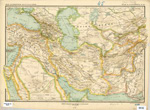
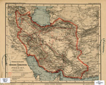
| G7620 | Карта Персіи, Афганистана, и Белуджистана / составлена по новѣйшимъ свѣдѣніямъ въ Военно топографическомъ отдѣлѣ Кавказскаго военнаго округа [Karta Persīi, Afganistana, i Beludzhistana / sostavlena po novi͡eĭshim svi͡edi͡enīi͡am v Voenno topograficheskom otdi͡eli͡e Kavkazskago voennago okruga]. | Iran--Maps. Afghanistan--Maps. Balochistān (Pakistan)--Maps. |
Scale 1:2,100,000. Г. Тифлис [G. Tiflis] : Въ Военно топографическомъ отдѣлѣ Кавказскаго военнаго округа [V Voenno topograficheskom otdi͡eli͡e Kavkazskago voennago okruga], 1881. 1 map on 6 sheets : color ; 88 x 136 cm, sheets 71 x 51 cm. or less. | |
 |
G7621 | Übersichtskarte der Verkehrs-Verhältnisse von Persien. | Transportation--Iran--Maps. | Scale 1:7,500,000. Gotha : Justus Perthes, 1885. 1 map : color ; 26 x 31 cm, on sheet 28 x 34 cm. |
 |
G7621 | Kriegsschauplatz zwischen Russland und Persien. | Russia--History--Nicholas I, 1825-1855--Maps. Iran--History--Qajar dynasty, 1794-1925--Maps. Russia--Foreign relations--Iran--Maps. Iran--Foreign relations--Russia--Maps. Turkey--Maps. |
Scale approximately 1:4,700,000. Berlin : Bei Simon Schropp & Co., 1826. 1 map : color ; 53 x 65 cm. |
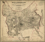 |
G7623.A85 | Map of Aderbeijan : compiled principally from personal observations and surveys made in the years 1851-55 by N. Khanikof / drawn and engraved under the general direction of H. Kiepert. | Azerbaijan (Iran)--Maps. | Scale 1:800,000. Berlin : D. Reimer, 1862. 1 map : hand coloed ; 49 x 54 cm. |
 |
G7630 | Afghanistan, Belutschistan, und angrenzende Gebiete. | Afghanistan--Maps. Pakistan--Maps. Tajikistan--Maps. Khyber Pass (Afghanistan and Pakistan)--Maps. |
Scale 1:7,500,000. Gotha : Justus Perthes, 1878. 1 map : color ; 25 x 19 cm, on sheet 28 x 22 cm. |
 |
G7630 | Théâtre du conflit Anglo-Afghan / gravé par R. Hausermann. | Afghan Wars--Maps. Afghanistan--Maps. Pakistan--Maps. |
Scale 1:3,024,000. Paris : Imp. Becquet, 1878. 1 map : color ; 22 x 29 cm. |
 |
G7630 | Carte de l'Afghanistan et des frontières nord-ouest de l'Inde et sud de la Russie d'Asie : pour suivre les opérations de l'armée anglaise, d'après les documents russes, anglais et allemands les plus récents / gravé par A. Martin. | Afghanistan--Maps. | Scale approximately 1:5,000,000. Paris : Librairie Ch. Delagrave, 1879. 1 map : color ; 43 x 32 cm. |
 |
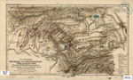
G7630 | Quetta to Khelat-i-Ghilzai & Girishk : a rough combination of surveys and reconnaissances, 1878-79-80. | Afghanistan--Maps. Balochistān (Pakistan)--Maps. |
Scale approximately 1:253,440. Calcutta : Photozincographed at the Surveyor General's Office, 1880. 1 map ; on sheet 146 x 108 cm. |
  |
G7630 | Seat of war in northern Afghanistan. | Afghanistan--Maps. | Scale 1:253,440. Calcutta : Surveyor General's Office, 1880. 1 map : color ; 99 x 134 cm. |
 |
G7631 | Das Grenzgebiet von Buchara und Afghanistan (Pamir und Quellen des Oxus) : Übersicht der russischen Forschungs-Expeditionen von A. Regel, Iwanow, Putjata & Benderski, 1882 & 1883, sowie dem Punditen vom Indischen-Vermessungscorps Munschi-Abdul-Subhan, 1878-1881 / nach provisorischen Materialien u. älteren Quellen entworfen u. gezeichnet v. B. Hassenstein ; autogr. v. C. Schmidt u. B.H. | Afghanistan--Discovery and exploration--Maps. Tajikistan--Discovery and exploration--Maps. |
Scale 1:1,700,000. Gotha : Justus Perthes, 1884. 1 map : color ; 25 x 42 cm, on sheet 29 x 47 cm. |
 |
G7633.K2 | Die Landschaft zwischen Kabul und dem Indus : vorzüglich nach dem India-Atlas (1860-68) mit Zusätzen nach dem Recognoscirungen von Lt. Stuart, Faiz-Baksch, u. a. / redig. v. H. Kiepert ; Terrain v. W. Greve. | Kabul (Afghanistan : Province)--Maps. Nangarhār (Afghanistan)--Maps. North-west Frontier Province (Pakistan)--Maps. Khyber Pass (Afghanistan and Pakistan)--Maps. |
Scale 1:600,000. Berlin : Verlag von D. Reimer, 1878. 1 map : color ; 22 x 58 cm. |
 |
G7640 | Die Indusländer nebst Afghanistan und Süd-Turkistan : zur Übersicht der Kriegsbegebenheiten, nach englischen und russischen Karten und Reiseberichten / bearbeitet von H. Kiepert ; gez. v. H. Kiepert ; gest. v. G. Haubold. | Pakistan--Maps. Afghanistan--Maps. Indus River Valley--Maps. |
Scale 1:4,000,000. Weimar : Verlag des Geograph. Instituts, 1849. 1 map : color ; 51 x 42 cm. |
| North Africa (including Egypt) | ||||
 |
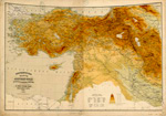
G8202.N5 | Die Nilländer oder Aegypten, Nubien und Habesch / nach C.F. Weilands Entwurf ; völlig umgearbeitet v. H. Kiepert. | Nile River Valley--Maps. Africa, North--Maps. Africa, Eastern--Maps. Egypt--Maps. Ethiopia--Maps. Eritrea--Maps. Sudan--Maps. Alexandria Region (Egypt)--Maps. |
Scale 1:5,000,000. Weimar : Verlag des Geographischen Instituts, 1848. 1 map : hand colored ; 61 x 47 cm. |
  |
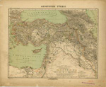
G8220 | Mittel- und Nord-Africa und Arabien / entw. u. gez. v. Pr. Lt. v. Stülpnagel ; gest. v. E. Edler. | Africa, North--Maps. Arabian Peninsula--Maps. Middle East--Maps. |
Scale approximately 1: 15,000,000. Gotha : Bei J. Perthes, 1830. 1 map on 2 sheets : hand colored ; 31 x 70 cm, sheets 37 x 45 cm. |
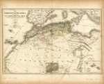 |
G8220 | Das Nordwestliche Africa : enthaltend die Staaten Fez und Marokko, Algier, Tunis und Tripoli, die Sahara, Canarischen und Azorischen Inseln / entworfen und gezeichnet 1840 von C.F. Weiland ; berichtigt 1846 von H. Kiepert ; C. Jungmann sc. | Africa, North--Maps. | Scale 1:6,325,000. Weimar : Im Verlage des Geograph. Instituts, 1849. 1 map : hand colored ; 41 x 64 cm. |
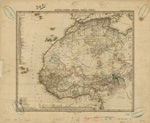 |
G8220 | Mittel- & Nord- Afrika : westl. Theil / entw. u. gez. v. Fr. v. Stülpnagel, 1848 ; ber. 1875 v. A. P. | Africa, North--Maps. Africa, West--Maps. |
Scale 1:14,000,000. Gotha : Justus Perthes, 1875. 1 map : color ; 32 x 38 cm. |
 |
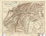
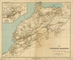
G8220 | N.W. Africa : comprising Marocco, Algeria & Tunis / by T.B. Johnston, geographer to the Queen. | Africa, North--Maps. Morocco--Maps. Algeria--Maps. Tunisia--Maps. Maps. |
Scale 1:4,522,426. [London] : [W. & A.K. Johnston], [between 1880 and 1889?]. 1 map : color ; 29 x 48 cm. |
 |
G8221 | Les forteresses et l'armée de la confrérie religieuse de Sîdi Es-Senoûsi en 1883 / par Henri Duveyrier, juillet 1883 ; dessiné par J. Hansen. | Sanūsī, Muḥammad al-Mahdī, 1844-1902--Military leadership--Maps. Senussites--Africa, North--Maps. Sufism--Africa, North--Maps. |
Scale 1:12,500,000. [Paris] : [Société de géographie], 1884. 1 map : color ; 23 x 41 cm, on sheet 29 x 43 cm. |
  |
G8221 | Carte de l'Afrique sous la domination des Romains / dressée au Dépôt de la guerre d'après les travaux de Mr. Fr. Lacroix ; par le capitaine d'état-major Nau de Champlouis, 1864 ; gravé par Erhard. . | Romans--Africa, North--Maps. Africa, North--History--To 647--Maps. |
Scale 1:2,000,000. [Paris] : Dépôt de la guerre, 1864. 1 map on 2 sheets : color ; 59 x 186 cm, sheets 67 x 97 cm. |
 |
G8221 | Provincia Africa / H. Kiepert, del. ; C.L. Ohmann, lith. | Africa, North--History--Maps. | Scale 1:1,000,000. [Berlin] : [Deutsche Akademie der Wissenschaften], [1891]. 1 map : color ; 34 x 58 cm, on sheet 39 x 65 cm. |
 |
G8230 | Carte de l'empire de Maroc : dressée d'après les observations faites en 1830 par M. Washington / gravé par Ambroise Tardieu. | Morocco--Maps. Marrakech (Morocco)--Maps. |
Scale approximately 1:2,750,000. [Paris] : Société de géographie, [1832]. 1 map ; 24 x 34 cm. |
  |
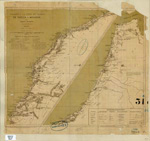
G8230 | Carte de l'Empire de Maroc : indiquant les communications principales, la division en gouvernmens, et la répartition de la population des diverses races sur le sol, ainsi que l'état d'obéissance des tribus qui sont comptées comme faisant partie de l'Empire de Maroc / par le capitaine d'état Major Beaudouin ; réduite et gravée au Dépôt général de la guerre. | Morocco--Maps. | Scale 1:1,500,000. Paris : Dépôt de la guerre, 1848. 1 map on 2 sheets ; 78 x 98 cm, sheets 84 x 54 cm. |
 |
G8230 | Das Sultanat Marokko / entworfen und gezeichnet von P. Schnell. | Morocco--Maps. | Scale 1:1,750,000. Gotha : Justus Perthes, 1892. 1 map ; 50 x 62 cm. |
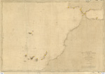 |
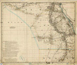
G8231 | Océan atlantique, côte occidentale d'Afrique, partie comprise entre le détroit de Gibraltar et le cap Bojador / gravé par Chassant ; écrit par V. Carré. | Nautical charts--Morocco. Nautical charts--Canary Islands. Nautical charts--Madeira Islands. Nautical charts--Gibraltar, Strait of. |
Scale approximately 1:2,236,000. [Paris] : Dépôt des cartes et plans de la marine, [1873]. 1 map : hand colored ; 60 x 88 cm. |
 |
G8232.C6 | Voyages à la côte du Maroc de Tanger à Mogador, par Auguste Beaumier, consul de France, 1855-1875 / dressée par J. Hansen, à l'aide de la feuille no.1165 de la Marine française, de la carte manuscrite de M.A. Beaumier, et de la carte inédite de M. Tissot, voyages de 1872 à 1875. | Beaumier, A. (Auguste)--Travel--Maps. Coasts--Morocco--Maps. Morocco--Discovery and exploration--Maps. |
Scale 1:800,000. [Paris] : [Société de géographie], [1876]. 1 map in 2 sections : color ; sheet 40 x 42 cm. |
 |
G8233.F4 | Esquisse topographique d'une partie du royaume de Fès / tracée par C. Tissot, 1872-1875 ; réduit de la carte manuscrite de Mr. Tissot et des flles. nos. 1711 et 1165 de l' Hydrographie française par J. Hansen ; gravé par Erhard. | Fès (Morocco : Province)--Maps, Topographic. | Scale 1:500,000. [Paris] : [Société de géographie], 1876. 1 map : color ; 47 x 37 cm. |
 |
G8234.M2 | Plan de la ville de Maroc (la Rouge) = مراكش الحمرة [Marrākush al-ḥamrah] / levé par Paul Lambert, 1867 ; revu et augmenté par Augte. Beaumier, à Maroc, février 1868 ; gravé par Erhard. | Marrakech (Morocco)--Maps. | Scale approximately 1:8,000. [Paris] : [Société de géographie], 1868. 1 map ; 31 x 20 cm. |
  |
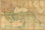
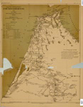
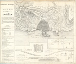
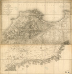
G8240 | Carte générale de l'Algérie / dressée au Dépôt de la guerre d'après les cartes particulières des provinces publiée par le Dépôt de la guerre, les relèvements de la Marine, les renseignements recueillis en Afrique, etc. ; gravée au Dépôt de la guerre ; le trait par Boclet et Rouillard ; la lettre par Hacq ; la topographie et les eaux par Orgiazzi. | Algeria--Maps. | Scale 1:1,600,000. Paris : Dépôt de la guerre, 1856. 1 map on 2 sheets ; 64 x 110 cm, on sheets 74 x 63 cm and 74 x 60 cm. |
 |
G8240 | Carte du Sahara oriental : d'après les reconnaissances exécutées par les officiers d'Etat-Major employés à l'Armée d'Afrique / gravé sur pierre par Erhard. | Algeria, Southern--Maps. | Scale 1:400,000. [Paris] : Depôt de la guerre, 1861. 1 map ; 68 x 98 cm. |
 |
G8240 | L'Algérie oro-hydrographique. | Algeria--Maps. | Scale approximately 1:2,700,000. [Paris] : [publisher not identified], [approximately 1880]. 1 map : color ; 26 x 38 cm, on sheet 37 x 55 cm. |
  |
G8240 | Carte de l'Algérie à l'échelle de 1 m. pour 1,600,000 m. / dressée au Dépôt de la guerre. | Algeria--Maps. | Scale 1:1,600,000. [Paris] : Dépôt de la guerre, [188-?]. 1 map on 2 sheets : hand colored ; 68 x 110 cm, sheets 71 x 58 cm. |
 |
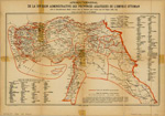
G8240 | Algérie : d'après les documents publiés par le Ministère de la guerre et des travaux inédits / par le commandant Niox. | Algeria--Maps. | Scale 1:1,600,000. Paris : Librairie Hachette, 1884. 1 map : color ; 47 x 64 cm, on sheet 58 x 74 cm. |
 |
G8240 | Algérie et Tunisie : d'après les documents fournis par le Dépôt de la guerre (Service géographique) / orthographie des noms arabes d'après les principes du Général Parmentier ; dessinée par J. Hansen ; gravée par E. Morieu. | Algeria--Maps. Tunisia--Maps. |
Scale 1:1,800,000. Paris : Lith. Lemercier & Cie., 1885. 1 map : color ; 51 x 71 cm, on sheet 57 x 82 cm. |
 |
G8240 | Carte d'une partie du Sahara septentrional / dressée par F. Foureau d'après l"Etat-Major, les documents les plus récents, et les travaux, cartes ou itinéraires de Mr.Mr. Duveyrier ... [and others]. | Algeria, Southern--Maps. | Scale 1:1,000,000. [Paris] : Ministère des travaux publics, 1888. 1 map : color ; 79 x 63 cm. |
 |
G8240 | Carte de l'Algérie et de la Tunisie / dressée par E. Levasseur. | Algeria, Southern--Maps. Tunisia--Maps. |
Scale 1:1,000,000. Paris : Institut géographique de Paris, Ch. Delagrave, [1890?]. 1 map : color ; 71 x 139 cm, on sheet 92 x 176 cm. |
 |
G8240 | Algérie et Tunisie / gravé et imprimé par S. Krakow. | Algeria--Maps. Tunisia--Maps. |
Scale 1:2,000,000. Paris : Institut géographique de Paris, Ch. Delagrave, [probably between 1890 and 1892]. 1 map : color ; 39 x 65 cm. |
 |
G8240 | Algérie (avec la Régence de Tunis) / par E. Levasseur ; gravé chez L. Wuhrer. | Algeria--Maps. Tunisia--Maps. |
Scale 1:3,500,000. Paris : Institut géographique de Paris : Ch. Delagrave, [189-?]. 1 map : color ; 25 x 39 cm, on sheet 35 x 54 cm. |
  |
G8241 | Réseau des chemins de fer de la compagnie Bône-Guelma et prolongements, Algérie et Tunisie / carte dressée par les soins de la Compagnie ; L. Billiard et R. Bida, del. | Compagnie de Bône à Guelma--Maps. Railroads--Algeria--Maps. Railroads--Tunisia--Maps. |
Scale approximately 1:325,000. Paris : Compagnie de Bône à Guelma, [188-?]. 1 map : color ; 151 x 213 cm. |
 |
G8241 | Chemins de fer algériens : situation au 31 décembre 1881. | Railroads--Algeria--Maps. Railroads--Tunisia--Maps. |
Scale 1:3,000,000. Paris : Ministère des travaux publics, Direction des chemins de fer, [1881?]. 1 map : color ; 35 x 42 cm. |
 |
G8241 | Carte de la côte septentrionale d'Afrique : (partie comprise entre Alger et les iles Zafarines) / levée en 1831, 1832, et 1833, par M.A. Bérard ; gravé par Chassant ; ecrit par J.M. Hacq. | Nautical charts--Algeria. Coasts--Algeria--Maps. Maps. |
Scales approximately 1:672,000. [Paris] : Dépôt général de la marine, [1870]. 1 map : hand colored ; 57 x 85 cm. |
 |
G8242.M9 | Carte des kçour du Mzab (Vallée de l'Oued Mzab) / carte dressée par le Dr. Huguet ; avec la collaboration des lieutts. P. Peltier et F. Goubeau. | Mzab (Algeria)--Maps. Ghardaïa (Algeria)--Maps. |
Scale 1:20,000. [Algiers] : Gouvernement général d'Algérie, Service des cartes et plans, 1899. 1 map ; 30 x 45 cm, on sheet 57 x 50 cm. |
 |
G8243.C6 | Algérie, province de Constantine. Feuille 1ère / gravé sur pierre par Erhard Schieble. | Constantine (Algeria : Wilāyah)--Maps. | Scale 1:400,000. [Paris?] : [Dépôt de la guerre?], 1869. 1 map ; 52 x 84 cm. |
 |
G8243.O7 | Carte topographique de la subdivision d'Oran / d'après les levés des officiers d'Etat-Major ; cette carte a été presqu'entièrement levée par Mr. le Capitaine d'Etat-Major Desmonts ; gravé sur pierre par Erhard. | Oran (Algeria : Province)--Maps. | Scale 1:100,000. Paris : Dépôt de la guerre, 1853. 1 map ; 74 x 107 cm. |
 |
G8243.O7 | Le Sud-oranais et les parties limitrophes du Marok à l'échelle du 1,600,000e / par O. Mac Carthy, Alger, Oran, Paris, août-septembre 1881 ; gravé par A. Martin. | Oran (Algeria : Province)--Maps. Morocco--Maps. |
Scale 1:1,600,000. Paris : Librairie Charles Delagrave, [1881?]. 1 map : color ; 65 x 52 cm. |
 |
G8244.A6 | Plan und Karte der Küste von Algier : nebst einer Küsten-Karte der westlichen Hälfte des Mittelländischen Meeres / entworfen und nach den besten französischen Karte für den Umdruck gezeichnet vom K.P. Ingenieur-Geographen Glaeser. | Algiers (Algeria)--Maps. Algiers Region (Algeria)--Maps. Coasts--Algeria--Maps. |
Scale approximately 1:13,000. [Germany?] : [publisher not identified], [between 1820 and 1829?]. 1 map ; 31 x 26 cm, on sheet 34 x 52 cm. |
 |
G8244.A6 | Alger : son port, ses fortifications et une partie de ses environs d'après d'anciens documens authentiques et des renseignements récens communiqués par M.X. Bianchi, adjoint à la Mission de Mr. le Comte de la Bretonniere en Juillet 1829, auprès de la Régence d'Alger, indication des améliorations et travaux effectués ou projéte par les Français depuis l'occupation de cette ville en Juillet 1830 = Djezaïr = الجزائر [Al-Jazāʼir] / tracés sur les lieux par M. Gibou ; Laurent del. et sculp. | Algiers (Algeria)--Maps. | Scale approximately 1:12,500. [Paris] : [Société de géographie], [1830]. 1 map ; 32 x 43 cm, on sheet 46 x 56 cm. |
 |
G8244.A6 | Carte du territoire d'Alger / dressée au Dépôt général de la guerre par ordre de M. le maréchal duc de Dalmatie ; sous la direction de M. le lieutenant général Pelet ; d'après les levés de M.M. les officiers d'état-major employés à l'armée d'Afrique, Paris 1834. | Algiers Region (Algeria)--Maps. | Scale 1:50,000. [Paris] : [Dépôt général de la guerre], [1864]. 1 map ; 93 x 91 cm. |
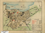  |
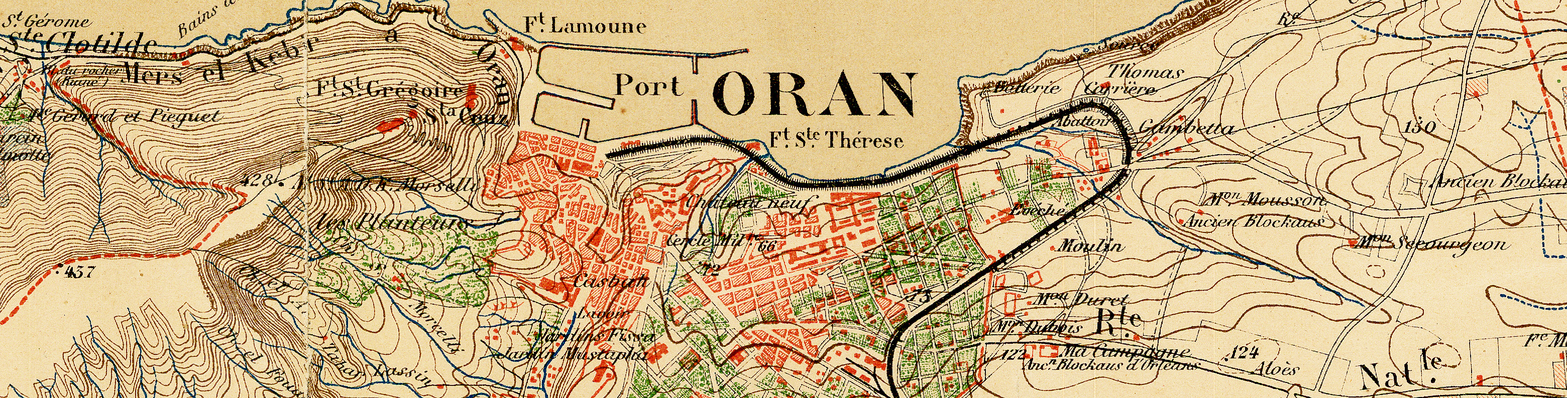
G8244.O2 | [Plan d'Oran]. | Oran (Algeria)--Maps. | Scale approximately 1:23,500. [Paris?] : [Association française pour l'avancement des sciences?], [1888] 1 map : color ; 12 x 16 cm. |
 |
G8244.O2 | Environs d'Oran / dessiné, les courbes de nivellement par M.I. Derrien, capne. d'Etat major ; le trait et les écritures par M. Bouvain, dessinateur ; levé en juin et juillet 1874 par M.I. Derrien. | Oran Region (Algeria)--Maps, Topographic. | Scale 1:40,000. [France] : [publisher not identified], [1874?]. 1 map : color ; 57 x 71 cm. |
  |
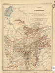
G8250 | Carte de la Régence de Tunis / dressée au Dépôt de la guerre. | Tunisia--Maps. Algeria--Maps. |
Scale 1:400,000. Paris : Dépôt de la guerre, 1857. 1 map on 2 sheets ; 126 x 92 cm. |
 |
G8250 | Carte de la Régence de Tunis / par Henri Kiepert. | Tunisia--Maps. | Scale 1:800,000. Berlin : Dietrich Reimer, 1881. 1 map : color ; 44 x 56 cm. |
  |
G8250 | Carte de la Tunisie / dressée au Service géographique de l'Armée. | Tunisia--Maps. | Scale 1:800,000. Paris : Service géographique de l'Armée, 1894. 1 map on 2 sheets : color ; 103 x 64 cm, sheets 59 x 69 cm. |
 |
G8251 | Itinéraires au Sahara tunisien / levés et dessinés par Victor Cornetz, ingénieur civil, 1891-1894. | Tunisia--Discovery and exploration--Maps. | Scale 1:800,000. Paris : Société de géographie, 1896. 1 map : color ; 46 x 29 cm. |
 |
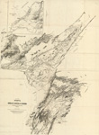
G8252.J3 | Carte du Bassin des Chotts / dressée en 1876 par le Capitaine Roudaire ; gravé par L. Sonnet. | Jarīd, Shaṭṭ al-, Region (Tunisia)--Maps. | Scale 1:400,000. Paris : Ministère de l'instruction publique, [1876?]. 1 map : color ; 42 x 98 cm, on sheet 65 x 07 cm. |
 |
G8252.J3 | Carte du Bassin des Chotts / dressée en 1880 par le Capitaine Roudaire ; gravé par L. Sonnet. | Jarīd, Shaṭṭ al-, Region (Tunisia)--Maps. | Scale 1:400,000. Paris : Ministère de l'instruction publique, Archives des missions scientifiques et littéraires, [1880?]. 1 map : color ; 42 x 98 cm, on sheet 65 x 107 cm. |
 |
G8254.T8 | Tunis, 1896. | Tunis (Tunisia)--Maps. | Scale 1:8,000. [Tunis] : Guide-annuaire tunisien, [1896]. 1 map : color ; 35 x 37 cm, on sheet 43 x 50 cm. |
 |
G8261 | Übersichtskarte von G. Rohlfs' Expedition in Tripolitanien, Barka und der Oasengruppe von Kufra, Dec. 1878 bis Oct. 1879 / entw. u. gez. von B. Hassenstein ; aut. von B. Domann & C. Schmidt. | Rohlfs, Gerhard, 1831-1896--Travel--Maps. Libya--Discovery and exploration--Maps. |
Scale 1:4,000,000. Gotha : Justus Perthes, 1880. 1 map : color ; 25 x 30 cm, on sheet 36 x 34 cm. |
 |
G8300 | Unter Aegypten / entworfen von J. Rennell. | Egypt--Maps. Nile River Delta (Egypt)--Maps. |
Scale approximately 1:1,500,000. [Germany?] : [publisher not identified], [between 1800 and 1809?]. 2 maps on 1 sheet ; sheet 29 x 48 cm. |
 |
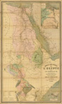
G8300 | Nouvelle carte historique & politique de l'Egypte, de la Palestine, et de la Syrie : rédigée d'après les itinéraires les plus nouveaux / présentée à l'Académie des sciences par L. Berthe. | Egypt--Maps. Palestine--Maps. |
Scale approximately 1:2,300,000. Paris : L. Berthe, editeur, géographe, [between 1870 and 1889?]. 1 map : hand colored ; 51 x 73 cm. |
 |
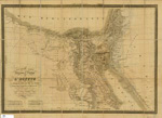
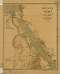
G8300 | Egypte et Soudan / dessiné et gravé par R. Hausermann. | Egypt--Maps. Sudan--Maps. |
Scale 1:5,555,000. [Paris] : [publisher not identified], [between 1880 and 1884]. 1 map : color ; 48 x 39 cm. |
   |
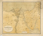
G8300 | Lower Egypt : in 4 sheets / compiled at the Intelligence Branch, War Office, from the original French survey in 1818 by M. Jacotin, from the manuscript of Mahmud Bey, and from the most recent information. | Egypt--Maps. | Scale 1:200,000. [London] : Intelligence Dept., War Office, 1882. 1 map on 4 sheets : color ; 108 x 168 cm. |
 |
G8300 | Map of lower Egypt and of the adjacent country with part of Palestine / compiled in the office of the Chief of Engineers, U.S. Army, August 1882 ; Denis Callahan, deltr. | Egypt--Maps. | Scale approximately 1:1,000,000. [Washington] : Office of the Chief of Engineers, 1882. 1 map : color ; 59 x 72 cm. |
 |
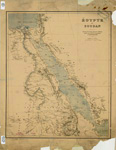
G8300 | Egypte et Soudan / dessiné et gravé par R. Hausermann. | Egypt--Maps. Sudan--Maps. |
Scale 1:5,555,000. Paris : [Le temps], 1884. 1 map : color ; 48 x 39 cm. |
 |
G8301 | Aegyptus antiqua, Karte von Unter-Aegypten (20 Nomoi umfassend) / enworfen von H. Brigsch-Bey. | Egypt--Historical geography--Maps. | Scale approximately 1:500,000. Leipzig : J.C. Hinrichs'sche Buchhandlung, 1875. 1 map : color ; 43 x 72 cm. |
 |
G8301 | Aegyptus antiqua, Karte von Ober-Aegypten (22 Nomoi umfassend) / entworfen von H. Brugsch-Bey. | Egypt--Historical geography--Maps. Egypt--History--To 332 B.C.--Maps. Egypt--Antiquities--Maps. |
Scale approximately 1:1,550,000. Leipzig : J.C. Hinrichssche Buchhandlung, 1877. 1 map : color ; 28 x 42 cm. |
 |
G8301 | Karte von Inner-Afrika. Blatt 2, Ägypten / autographirt von E. Debes & A. Welcker. | Egypt--Discovery and exploration--Maps. Sudan--Discovery and exploration--Maps. Thematic maps. |
Scale 1:2,000,000. Gotha : Justus Perthes, 1862. 1 map : color ; 44 x 53 cm. |
 |
G8301 | Nouvelle carte générale de l'Egypte, donnant les sources du Nil découvertes par Speke et Grant, dressée d'après les documents officiels accompagnée d'un plan topographique du canal de l'Isthme de Suez et d'un planisphère indiquant les distances par mer entre les divers pays du monde / gravé par Erhard Schièble. | Speke, John Hanning, 1827-1864--Travel--Maps. Grant, James Augustus, 1827-1892--Travel--Maps. Egypt--Discovery and exploration--Maps. Nile River Valley--Discovery and exploration--Maps. Thematic maps. |
Scale 1:444,444. Paris : E. Andriveau-Goujon, [1879?]. 1 map : color ; 98 x 56 cm. |
 |
G8302.S5 | Map of the peninsula of Mount Sinai and Arabia Petraea : from the itineraries of E. Robinson and E. Smith / drawn by H. Kiepert. | Robinson, Edward, 1794-1863--Travel--Maps. Smith, Eli, 1801-1857--Travel--Maps. Sinai (Egypt)--Maps. Palestine--Maps. |
Scale 1:800,000. Boston : Crocker & Brewster, [1868]. 1 map : color ; 51 x 41 cm. |
     |
G8302.S9 | Suez Canal / gravé par Avril frères. | Suez Canal (Egypt)--Maps. | Scales differ. Paris : Imp. Chezaud, [1863?]. 3 maps and 5 profiles on 5 sheets: col ; sheets 36 x 86 cm or smaller. |
 |
G8304.A5 | Carte des environs d'Alexandrie : contenant le lac Maréotis, ceux d'Aboukir et d'Edkou, ainsi que les anciens cours d'eaux et les villes dont les emplacements y sont déterminés par mes propres recherches / dressée par Mahmoud-Bey, astronome de S.A. le Vice-Roi d'Egypte ; gravé chez Erhard. | Alexandria Region (Egypt)--Maps. Alexandria (Egypt)--Maps. |
Scale 1:200,000. Paris : Imp. Monrocq, 1866. 1 map : color ; 28 x 47 cm, on sheet 36 x 55 cm. |
 |
G8304.A5 | Carte de l'antique Alexandrie et de ses faubourgs / dressée sur les ordres de S.A. le vice-roi d'Egypte à l'aide de fouilles, nivellements et autres recherches par Mahmoud-Bey ; gravé chez Erhard. | Alexandria (Egypt)--History--Maps. | Scale 1:20,000. Paris : Monrocq, 1866. 1 map : color ; 63 x 28 cm, on sheet 71 x 37 cm. |
 |
G8304.C2 | Le Caire / A.H. Dufour, direx ; Gavard, sculp. ; Bénard, scrip. | Cairo (Egypt)--Maps. | Scale approximately 1:31,500. Paris : Jules Renouard, [183-?]. 1 map ; 17 x 26 cm, on sheet 23 x 28 cm. |
 |
G8304.C2 | Le Caire (Maşr el Ḳâhirah). | Cairo (Egypt)--Maps. Cairo Region (Egypt)--Maps, Physical. |
Scale 1:50,000. [France?] : [publisher not identified], [1889]. 1 map ; 12 x 11 cm, on sheet 28 x 22 cm. |
 |
G8304.C2 | Le Caire et ses environs : sa plaine avant de fondation de la ville. | Cairo Region (Egypt)--Maps. Cairo Region (Egypt)--Maps, Physical. |
Scale 1:150,000. [France?] : [publisher not determined], [1889]. 1 map ; 17 x 12 cm, on sheet 28 x 22 cm. |

