Earth Day spatial resources spotlight: Big Ten Academic Alliance Geoportal
In celebration of Earth Day, the University of Chicago Library is spotlighting spatial data resources for environmental research and learning.
The Big Ten Academic Alliance Geoportal is an open geospatial data and map resource operated by the librarians and GIS specialists of its member institutions, including the University of Chicago Library. Many of the collections are also from state and local GIS departments that manage regional geospatial data. The Geoportal covers a wide variety of formats, including shapefiles, aerial imagery, and historical maps. To learn more about what’s available in the geoportal, check out the BTAA Geoportal News site.
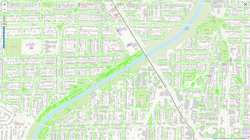
To find environmental datasets, start with the Subject filter that includes topics like biota, geology, inland waters, and farming. For example, if you want to know the spatial distribution of trees in Evanston for environmental evaluation, you can download the shapefile showing the location of each individual tree in Evanston (see figure). All the data layers are available as high resolution downloads for use in class or for research. A range of tutorials are also provided for independent or class use, including:
- An introduction to the types of geospatial information
- Finding maps and spatial data on a particular topic
- Evaluating geospatial data
- Using GIS web services
- Linking tabular data to geospatial data.
Another powerful feature of the BTAA Geoportal is the spatial search. Users can zoom into an area of interest and see the modern data and historical maps within that location. This is an interesting way to explore changing landscapes through time.
For help accessing and using these spatial data resources please contact the GIS & Maps Librarian Cecilia Smith, ceciliasmith@uchicago.edu.

