Earth Day spatial resources spotlight: International topographic maps
In celebration of Earth Day, the University of Chicago Library is spotlighting spatial data resources for environmental research and learning.
The University of Chicago Library Map Collection collects maps and data from around the world. A few areas to highlight are maps covering Asia, Latin America, and Europe. While a range of environmental topics are available through these maps, many researchers use topographic maps to understand urban and land development over time.
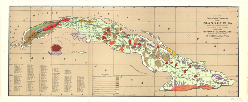
Topographic maps show both the natural and built environment. By comparing maps of the same region from different time periods, viewers can see the changes brought on by human intervention and natural phenomena. This 1930 map of sugar plantations in Cuba is an excellent example of a historical topographic map with agricultural land use and infrastructure information that can be compared with other Cuban maps from different time periods.
UChicago students, faculty, and staff may request a high-resolution copies of physical maps through the Scan and Deliver service. For help accessing and using these spatial data resources please contact the GIS & Maps Librarian Cecilia Smith, ceciliasmith@uchicago.edu.
