Paris in the 19th Century
|
|
Paris in the 19th Century
Click on the links below to access scans of some of the maps and views of 19th-century Paris that are held at the University of Chicago Library's Map Collection.
The maps document the transformation of Paris from a compact city of half a million in 1800 into an industrial metropolis of nearly 3.5 million a century later. In the intervening years Paris acquired a more or less modern water system with the building of the Canal de l'Ourcq (1802-1822). It became the center of an elaborate railway network (starting from the 1840s). Numerous new streets, many created under the aegis of Baron Haussmann (in the 1850s and 1860s), were run through the old medieval core. Construction of an underground railroad system (the Métro) began (the first line opened in 1900). And an elaborate system of fortifications was built--which did not prevent French defeat in the Franco-Prussian War.
Many of the maps come from the collection of cartographic materials that was assembled by French geographer Emile Levasseur (1828-1911), bought by the old John Crerar Library in 1914, and acquired by the University of Chicago Library in 1930-1931.
We have included several maps whose compilers, publishers, and dates of production we do not know. We would be very grateful for information that would allow us to identify these publications with greater precision.
This page provides access only to a small proportion of the Paris maps that are held at the University of Chicago Map Collection. Additional maps are listed in the Library's on-line catalog. The best way to find them is probably to do subject keyword searches on "Paris and maps" and "Paris and views," limiting by date (and perhaps format). This approach should work for finding English-language records on WorldCat and in other North American libraries' catalogs as well. Doing this search on WorldCat also turns up several Paris maps on the Internet. Additional maps of the Paris area can be found in most libraries' collections of topographic maps.
For a published compilation of Paris maps, see: Les plans de Paris : histoire d'une capitale by Pierre Pinon and others (Paris : Passage, 2004). Atlas de Paris : évolution d'un paysage urbain by Danielle Chadych and Dominique Leborgne (Paris : Parigramme, 1999) is a fine atlas that focuses on the history of Paris planning. There is an enormous literature on 19th-century Paris. See, for example, L'invention de Paris : il n'y a pas de pas perdus by Eric Hazan (Paris : Seuil, 2002) [translated as: The invention of Paris : a history in footsteps (London : Verso, 2010)].
The maps were scanned at 400 dpi using NextImage software and were saved as tiff files
You can access these files in two different ways:
[1] Click on the thumbnails below to see the files in a program called Zoomify. Zoomify breaks the original tiff files into tiny jpegs, so you can zoom in and out and move around quickly and efficiently. Zoomify requires Flash and so won't work on many mobile phones.
[2] You can also see the files through Luna. Luna, like Zoomify, allows you to zoom in and out and to move around. It also allows download of jpeg versions of the files (click "Export"). To access the Luna files, click on the "Click here for Luna version" button.
The original tiff files are also available. E-mail from the "Questions about this page?" button below.
Downloaded files are freely available for personal or scholarly use. If you use the images in a publication, we expect that you will mention that the original maps--and the files--are from the University of Chicago Library's Map Collection.
Joel Thomas of the Map Collection did essentially all the scanning, most of the record manipulation, and a modest amount of Photoshop editing. He also did some last-minute preservation work on a few of the sheets. The University of Chicago Library's Digital Library Development Center did the necessary server preparation. And former bibliographer Frank Conaway (and others) made useful editorial suggestions about this text. Bridget Madden of the University of Chicago's Visual Resources Center and Charles Blair of the Library's Digital Library Development Center developed a protocol in 2015 that allows access via Luna. And Bobby Butler of the Map Collection edited the Map Collection pages to point to the Luna versions.
The links below are listed in chronological order.
Comments are welcome.
--CW
| Image | Title Information | Subject Headings | Description |
|---|---|---|---|
 |
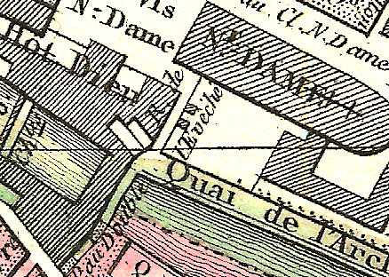
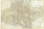
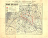
Nouveau plan de la ville de Paris. | Paris (France)-Maps. | Scale [ca. 1:17,000]. Weimar : Bureau d'Industrie, 1802. 1 map ; 36 x 42 cm., on sheet 43 x 51 cm. |
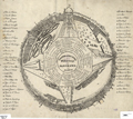 |
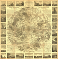
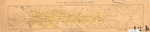
Topographische Erklärung des Panorama von Paris. | Paris (France)-Aerial views. | Not drawn to scale. [Germany? : s.n., between 1800 and 1809?] 1 view ; 31 x 35 cm. |
 |
Plan routier de la ville et fauxbourgs de Paris, divisé en douze mairies. | Paris (France)-Maps. | Scale [ca. 1:12,000]. Paris : Chez Jean, 1810. 1 map : hand col. ; 36 x 56 cm., on sheet 42 x 58 cm. |
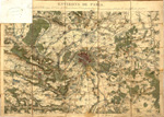 |
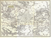
Environs de Paris / dressés par Beuvelot (J.B.) d'après la Carte des chasses, d'autres cartes particulières et des reconnaissances faites par lui sur différents points ; Beuvelot delt. ; F.P. Michel sct. | Paris Region (France)-Maps. | Scale [ca. 1:102,500]. [Paris : Beuvelot, between 1810 and 1829]. 1 map : hand col. ; 56 x 82 cm. Library copy missing northwest corner. |
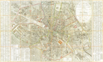 |
Plan routier de la ville de Paris : divisé en XII arrondissements ou mairies et en 48 quartiers. | Paris (France)-Maps. | Scale [ca. 1:8,000]. Paris : Picquet, 1814. 1 map : hand col. ; 82 x 110 cm. |
 |
Nouvelle carte routière du voyageur aux environs de Paris : contenant les départemens de la Seine, de Seine et Oise, et partie de ceux adjacens, la seule ornée des vues des principaux monumens qui s'y trouvent situés. | Paris Region (France)-Maps. Paris (France)-Maps. |
Scale [1:100,000]. Paris : Chez le Roi, libraire-éditeur, 1827. 1 map ; 63 cm. in diam., on sheet 82 x 81 cm. |
 |
Paris / A.H. Dufour, direx. ; Gavard, sculp. ; Bénard, scrip. | Paris (France)-Maps. | Scale [ca. 1:38,000]. Paris : Jules Renouard, [183-?]. 1 map ; 20 x 26 cm. |
 |
Carte du territoire que traverse le canal de dérivation de la rivière d'Ourcq : depuis le village de Mareuil jusqu'à Paris, avec le tracé de canal. | Canals--France--Paris--Maps. | Scale [ca. 1:100,000]. [Paris : Carilian-Goeury, 1831]. 1 map ; 23 x 58 cm., on sheet 33 x 96 cm. |
 |
Carte de la forêt de Saint-Germain / dressé par A.M. Perrot ; gravé par Pierre Tardieu ; écrit par J.M. Hacq. | Saint-Germain-en-Laye (France)-Maps. | Scale 1:25,000. St.-Germain-en-Laye : A. Goujon, imprimeur, 1831. 1 map ; 49 x 60 cm., on sheet 53 x 64 cm. |
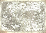 |
Plan von Paris / lith. von Schischa ; Terrain von Fritz. | Paris (France)-Maps. Paris Region (France)--Maps. |
Scale 1:49,240. [Vienna? : K.K. Militärisch-Geografisches Institut?, between 1845 and 1847?]. 1 map ; 48 x 70 cm. |
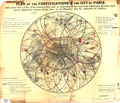 |
Plan of the fortifications of the city of Paris : with various lines of fire of the detached forts and an indication of the range of six thousand mètres which may be obtained by mortars of long bore, or à la Villantroys after the authorities of artillery. | Fortification--France--Paris--Maps. Fortification--France--Paris Region--Maps. |
Scale [ca. 1:75,000]. [New York? : Harper & Brothers?, 1848?]. 1 map : hand col. ; 31 cm. in diam., on sheet 40 x 46 cm. |
 |
Nouveau plan de Paris : à l'usage des promeneurs d'après la méthode Zugenbuhler, auteur d'un Atlas universel. | Paris (France)-Maps. Paris (France)--Maps, Tourist. |
Scale [ca. 1:8,500]. Paris : Augte. Logerot, 1857. 1 map : hand col. ; 43 x 59 cm. |
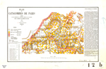 |
Plan des catacombes de Paris / dressé par les géomètres de l'Inspection générale des carrières sous la direction des ingénieurs des mines 1857. | Paris (France)-Maps. | Scale 1:1,000. Paris : Impr. de Lemercier, [1857]. 1 map : col. ; 25 x 41 cm., on sheet 32 x 49 cm. |
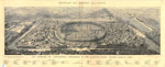 |
Vue générale de l'exposition universelle et des constructions élevées dans le parc : extrait du Monde illustré / A. Deroy ; E. Roevens. | Exposition universelle de 1867 à Paris--Aerial views. Paris (France)--Aerial views. Exhibitions--France--Paris--Aerial views. |
Not drawn to scale. Paris : Imprimerie Auguste Vallée, [1867]. 1 view ; 32 x 104 cm., on sheet 44 x 110 cm. |
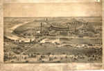 |
Exposition universelle de 1867 : vue générale prise des hauteurs du Trocadéro. | Exposition universelle de 1867 à Paris--Aerial views. Paris (France)--Aerial views. Exhibitions--France--Paris--Aerial views. |
Not drawn to scale. Paris : Ledot, aîné, [1867?]. 1 view ; 45 x 72 cm., on sheet 53 x 77 cm. |
 |
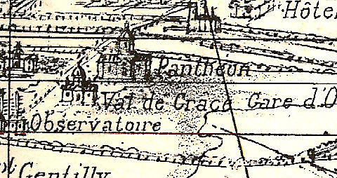
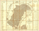
Plan géométral de Paris et de ses agrandissements à l'échelle d'un millimètre pour 10 m. (1/10,000). | Paris (France)-Maps. | Scale 1:10,000. Paris : E. Andriveau-Goujon, 1869. 1 map : hand col. ; 92 x 142 cm., on sheet 102 x 150 cm. |
 |
Paris und Umgebung während der Belagerung, 1870 und 1871. | Paris (France)--History--Siege, 1870-1871--Aerial views. Paris (France) -- Aerial views. Paris (France)--Aerial views. Paris Region (France)--Aerial views. |
Not drawn to scale. Zwickau : Verlag von Paul Werner, [187-?]. 1 view ; 53 x 89 cm., on sheet 63 x 96 cm. |
 |
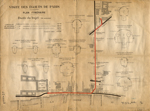
Plan de l'Avenue de l'Opéra / gravé par Marboutin. | Quartier de l'Opéra (Paris, France)--Maps. City planning--France--Paris--History--Maps. |
Scale 1:2,000. [Paris] : A. Lassailly, [187-?]. 1 map : col. ; 9 x 48 cm. |
 |
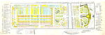
Nouveau plan complet et illustré de la ville de Paris, divisé en 20 arrondissements et en 80 quartiers / gravé par L. Sonnet. | Paris (France)-Maps. | Scale [ca. 1:20,000]. Paris : Le Bailly, [187-?]. 1 map ; 52 x 64 cm. |
 |
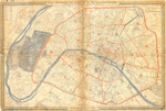
[Environs de Paris]. | Paris (France)-Maps. Paris Region (France)--Maps. |
Scale 1:40,000. [France? : s.n., 187-?]. 1 map ; 99 x 134 cm. |
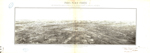 |
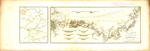
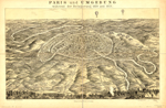
Paris place-forte : vue perspective exacte de Paris et de ses environs d'après la carte de l'État Major / dressée par P. Fauré. | Paris (France)--Aerial views. Paris Region (France)--Aerial views. |
Not drawn to scale. Paris : Imp. Lemercier & cie., [1871]. 1 view ; 30 x 100 cm. |
 |
Plan de l'Exposition universelle internationale de 1878 avec ses annexes. | Paris Universal Exposition of 1878-Maps. Exhibitions--France--Paris--Maps. |
Scale not given. [Paris : Bernardin Bechet?, 1878?]. 1 map : col. ; 23 x 72 cm., on sheet 31 x 90 cm. |
 |
Visite des égouts de Paris : plan itinéraire. | Sewerage--France--Paris--Tours--Maps. | Scale [ca. 1:5,000]. Paris : L. Courtier, [between 1880 and 1899?]. 1 map : col. ; 31 x 42 cm. |
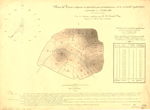 |
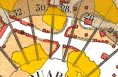
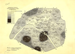
Plan de Paris, indiquant la répartition par arrondissement de mortalité typhoïdique, septembre et octobre 1882 : étude de statistique graphique / par A. Durand-Claye. | Typhoid fever--France--Paris--Maps. | Scale [ca. 1:60,000]. Paris : A. Broise & Courtier, [1883?] 1 map : hand col. ; on sheet 37 x 51 cm. |
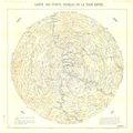 |
Carte des points visibles de la Tour Eiffel / A. Bourdon, del. | Paris Region (France)--Maps. | Scale 1:300,000. Paris : Imprimerie Ch. Unsinger, [1889?]. 1 map ; 67 x 67 cm., on sheet 74 x 75 cm. |
 |
Plan général de la ligne métropolitaine centrale : avec ses extensions differées et ses raccordements avec les grandes compagnies / présenté par la Compagnie des établissements Eiffel. | Subways--France--Paris--Maps. Subways--France--Paris--Planning--Maps. Local transit--France--Paris--Maps. |
Scale 1:25,000. [Paris] : Compagnie des établissements Eiffel, 1890. 1 map : col. ; 40 x 49 cm., on sheet 49 x 63 cm. |
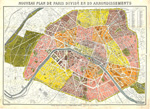 |
Nouveau plan de Paris divisé en 20 arrondissements / gravé par L. Poulmaire. | Paris (France)--Administrative and political divisions--Maps. Paris (France)--Maps. |
Scale 1:16,000. Paris : Librairie Théodore Lefèvre et cie., [ca. 1890?]. 1 map : col. ; 61 x 88 cm. |
 |
[Plan de Paris montrant la distribution des originaires de la Creuse]. | Immigrants--France--Paris--Maps. Paris (France)--Population--Maps. |
Scale [ca. 1:45,000]. [Paris? : s.n., between 1890 and 1899?]. 1 map ; 24 x 32 cm. |
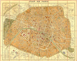 |
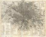
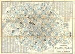
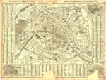
Plan de Paris / dressé par A. Vuillemin. | Paris (France)-Maps. | Scale 1:16,000. Paris : Librairie Hachette & cie., [1893]. 1 map : col. ; 63 x 78 cm. |
") ") |
Carte de la France. Paris / dressée par ordre du Ministre de l'intérieur ; gravée et imprimée par Erhard, graveur-géographe. | Paris (France)--Maps, Topographic. | Scale 1:100,000. Paris : Librairie Hachette et cie., 1884-1894. 2 maps : col. ; 33 x 44 cm., on sheets 45 x 58 cm. |

