Social Science Research Committee Maps
Chicago in the 1920s and 1930s: the View from the Chicago School
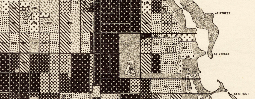
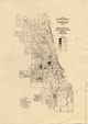
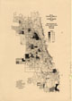
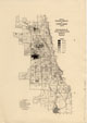
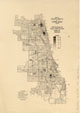
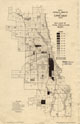
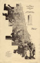
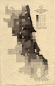
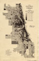
During the 1920s and 1930s numerous scholars at the University of Chicago did research on Chicago itself. These scholars, whose work is sometimes associated with the label "Chicago School," or "Chicago School of Sociology," played a major role in establishing urban studies as an important academic enterprise. The focus of these scholars varied, but a major concern for many--including Robert E. Park and Ernest W. Burgess--was the spatial structure of the city, which they tended to call its "ecology." One of the products of this research was a group of thematic maps of Chicago, based on census-tract-level data compiled for the 1920, 1930, and 1934 United States censuses. These maps are not very elegant and, in a few cases, are rather hard to read, but they are of great historic importance. Focusing on population density, ethnicity, housing, and living standards, they could be said to constitute the first thematic atlas of any U.S. city.
The maps show a city quite different from the Chicago we know today. Population density in inner-city areas was generally much higher than it is now. Neighborhoods where immigrants from particular European countries made up a large proportion (though rarely a majority) of the population were still common. Owner-occupancy was associated largely with the single-family homes at the edge of the city (the condominium would come to Chicago in 1963). Chicago in the 1920s and 1930s was, like Chicago today, a city of great economic contrasts, but the geography was quite different. The only close-to-downtown neighborhood that was truly wealthy was a tiny sliver of the Gold Coast. Virtually all of the other neighborhoods around the Loop that have one by one been gentrified over the last fifty years--even Lincoln Park--were among the poorest places in the city in the 1920s and 1930s. Conversely, outer-city neighborhoods like South Shore and Rogers Park that now have their share of problems were among the wealthiest. The Burgess zones of concentric development can be seen in many aspects of Chicago geography in the 20s and 30s.
All of these maps (even those that say "Dept. of Sociology") were produced under the aegis of the Social Science Research Committee or its immediate predecessor, the Local Community Research Committee. Funded by the Laura Spelman Rockefeller Memorial, this entity particularly focused on supporting Chicago research. It is not clear who actually made the maps, although Ernest W. Burgess was definitely among those who administered the analysis of the data that underlay them. The maps were republished by the University of Chicago Press in Census Data of the City of Chicago, 1920 (1931), Census Data of the City of Chicago, 1930 (1933), and Census Data for the City of Chicago, 1934 (1934), although the versions used in the construction of this Web site are earlier editions published as separate pieces and held at the University of Chicago Map Collection.
The maps were scanned at 360 dpi using NextImage software and were saved as tiff files
You can access these files in two different ways:
[1] Click on the thumbnails below to see the files in a program called Zoomify. Zoomify breaks the original tiff files into tiny jpegs, so you can zoom in and out and move around quickly and efficiently. Zoomify requires Flash and so won't work on many mobile phones.
[2] You can also see the files through Luna. Luna, like Zoomify, allows you to zoom in and out and to move around. It also allows download of jpeg versions of the files (click "Export"). To access the Luna files, click on the "Click here for Luna version" button.
The original tiff files are also available. E-mail from the "Questions about this page?" button below.
Downloaded files are freely available for personal or scholarly use. If you use the images in a publication, we expect that you will mention that the original maps--and the files--are from the University of Chicago Library's Map Collection.
Several people helped in the creation of this Web site. Justin Rounds of the Digital Library Development Center set up Zoomify. University Archivist Daniel Meyer provided information on the history of the Social Science Research Committee. Social sciences bibliographer Frank Conaway and map assistant George Stachokas offered useful comments on an earlier draft of this introduction. Charlotte Nuanes and Daniel Aguilar of the Map Collection helped manipulate the cataloging records. Bobby Butler cleaned up some of the scans in 2015, and Bridget Madden of the University of Chicago's Visual Resources Center and Charles Blair of the Library's Digital Library Development Center developed a protocol in 2015 that allows access via Luna. Finally, Bobby Butler and Emily Thompson of the Map Collection fixed up the html so that it would point to the Luna versions of the files.
See the companion Web page, Social Scientists Map Chicago, to access to additional Chicago School maps.See the Web page devoted to Harvey Choldin's Special Collections Research Center exhibit, Mapping the Young Metropolis, for a different view of the Chicago School and some Chicago School manuscript maps.
These were all created after 1922, and hence are subject to the provisions of U.S. copyright law. You should not reproduce the maps without obtaining the consent of the copyright holders.
The maps are listed below, classed by date.
--CW
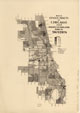
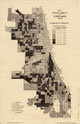
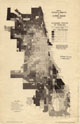
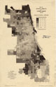
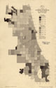
Census tracts of Chicago, 1920
| Image | Title Information | Subject Headings | Description |
|---|---|---|---|
 |
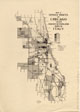
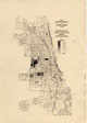
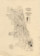
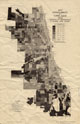
Census tracts of Chicago, 1920. Percent of population born in Czechoslovakia / prepared by Dept. of Sociology, University of Chicago. | Czech Americans--Illinois--Chicago--Maps. Slovak Americans--Illinois--Chicago--Maps. |
Scale [ca. 1:170,000]. [Chicago] : Dept. of Sociology, University of Chicago, [1928] |
 |
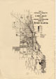
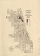
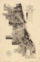
Census tracts of Chicago, 1920. Percent of population born in Germany / prepared by Dept. of Sociology, University of Chicago. | German Americans--Illinois--Chicago--Maps. | Scale [ca. 1:170,000]. [Chicago] : Dept. of Sociology, University of Chicago, [1928] |
 |
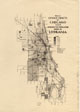
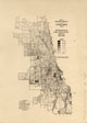
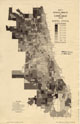
Census tracts of Chicago, 1920. Percent of population born in Ireland / prepared by Dept. of Sociology, University of Chicago. | Irish Americans--Illinois--Chicago--Maps. | Scale [ca. 1:170,000]. [Chicago] : Dept. of Sociology, University of Chicago, [1928] |
 |
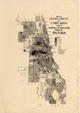
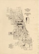
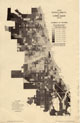
Census tracts of Chicago, 1920. Percent of population born in Italy / prepared by Dept. of Sociology, University of Chicago. | Italian Americans--Illinois--Chicago--Maps. | Scale [ca. 1:170,000]. [Chicago] : Dept. of Sociology, University of Chicago, [1928] |
 |
Census tracts of Chicago, 1920. Percent of population born in Jugo-slavia / prepared by Dept. of Sociology, University of Chicago. | Yugoslav Americans--Illinois--Chicago--Maps. | Scale [ca. 1:170,000]. [Chicago] : Dept. of Sociology, University of Chicago, [1928] |
 |
Census tracts of Chicago, 1920. Percent of population born in Lithuania / prepared by Dept. of Sociology, University of Chicago. | Lithuanian Americans--Illinois--Chicago--Maps. | Scale [ca. 1:170,000]. [Chicago] : Dept. of Sociology, University of Chicago, [1928] |
 |
Census tracts of Chicago, 1920. Percent of population born in Russia / prepared by Dept. of Sociology, University of Chicago. | Russian Americans--Illinois--Chicago--Maps. | Scale [ca. 1:170,000]. [Chicago] : Dept. of Sociology, University of Chicago, [1928] |
 |
Census tracts of Chicago, 1920. Percent of population born in Sweden / prepared by Dept. of Sociology, University of Chicago. | Swedish Americans--Illinois--Chicago--Maps. | Scale [ca. 1:170,000]. [Chicago] : Dept. of Sociology, University of Chicago, [1928] |
 |
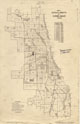
Census tracts of Chicago grouped into 148 areas showing population density per sq. mile, 1920. | Chicago (Ill.)--Population--Maps. | Scale [ca. 1:110,000]. [Chicago] : University of Chicago, c1934. |
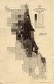
Census tracts of Chicago, 1930
| Image | Title Information | Subject Headings | Description |
|---|---|---|---|
 |
Census tracts of Chicago grouped into 148 areas showing increase or decrease of population, 1920 to 1930. | Chicago (Ill.)--Population--Maps. | Scale [ca. 1:110,000]. [Chicago] : University of Chicago, c1934. |
 |
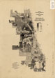
Census tracts of Chicago, 1930. Percentage of total population Negro. | African Americans--Illinois--Chicao--Maps. | Scale [ca. 1:170,000]. [Chicago] : Social Science Research Committee, University of Chicago, [between 1930 and 1934] |
 |
Census tracts of Chicago, 1930. Percentage of total population born in Czechoslovakia. | Czech Americans--Illinois--Chicago--Maps. Slovak Americans--Illinois--Chicago--Maps. |
Scale [ca. 1:170,000]. [Chicago] : Social Science Research Committee, University of Chicago, [between 1930 and 1934] |
 |
Census tracts of Chicago, 1930. Percentage of total population born in Germany. | German Americans--Illinois--Chicago--Maps. | Scale [ca. 1:170,000]. [Chicago] : Social Science Research Committee, University of Chicago, [between 1930 and 1934] |
 |
Census tracts of Chicago, 1930. Percentage of total population born in Ireland. | Irish Americans--Illinois--Chicago--Maps. | Scale [ca. 1:170,000]. [Chicago] : Social Science Research Committee, University of Chicago, [between 1930 and 1934] |
 |
Census tracts of Chicago, 1930. Percentage of total population born in Italy. | Italian Americans--Illinois--Chicago--Maps. | Scale [ca. 1:170,000]. [Chicago] : Social Science Research Committee, University of Chicago, [between 1930 and 1934] |
 |
Census tracts of Chicago, 1930. Percentage of total population born in Lithuania. | Lithuanians Americans--Illinois--Chicago--Maps. | Scale [ca. 1:170,000]. [Chicago] : Social Science Research Committee, University of Chicago, [between 1930 and 1934] |
 |
Census tracts of Chicago, 1930. Percentage of total population born in Poland. | Polish Americans--Illinois--Chicago--Maps. | Scale [ca. 1:170,000]. [Chicago] : Social Science Research Committee, University of Chicago, [between 1930 and 1934] |
 |
Census tracts of Chicago, 1930. Percentage of total population born in Russia. | Russian Americans--Illinois--Chicago--Maps. | Scale [ca. 1:170,000]. [Chicago] : Social Science Research Committee, University of Chicago, [between 1930 and 1934] |
 |
Census tracts of Chicago, 1930. Percentage of total population born in Sweden. | Swedish Americans--Illinois--Chicago--Maps. | Scale [ca. 1:170,000]. [Chicago] : Social Science Research Committee, University of Chicago, [between 1930 and 1934] |
 |
Census tracts of Chicago, 1930. Percentage of total population born in Yugoslavia. | Yugoslav Americans--Illinois--Chicago--Maps. | Scale [ca. 1:170,000]. [Chicago] : Social Science Research Committee, University of Chicago, [between 1930 and 1934] |
 |
Census tracts of Chicago, 1930. Percentage of total population foreign-born white. | European Americans--Illinois--Chicago--Maps. | Scale [ca. 1:170,000]. [Chicago] : Social Science Research Committee, University of Chicago, [between 1930 and 1934] |
 |
Census tracts of Chicago grouped into 180 areas showing population density per sq. mile, 1930. | Chicago (Ill.)--Population--Maps. | Scale [ca. 1:110,000]. [Chicago] : University of Chicago, c1934. |
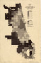
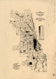
Census tracts of Chicago, 1934
| Image | Title Information | Subject Headings | Description |
|---|---|---|---|
 |
Census tracts of Chicago, 1934. | Census districts--Illinois--Chicago--Maps. Chicago (Ill.)--Population--Statistics--Maps. |
Scale [ca. 1:110,000]. [Chicago] : Social Science Research Committee, University of Chicago, c1934. |
 |
Census tracts of Chicago, 1934. Doubled-up families. | Housing--Illinois--Chicago--Maps. | Scale [ca. 1:110,000]. [Chicago] : Social Science Research Committee, University of Chicago, c1934. |
 |
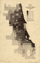
Census tracts of Chicago, 1934. Economic status of families. | Income--Illinois--Chicago--Maps. | Scale [ca. 1:110,000]. [Chicago] : Social Science Research Committee, University of Chicago, c1934. |
 |
Census tracts of Chicago, 1934. Educational status. | Education--Illinois--Chicago--Maps. | Scale [ca. 1:110,000]. [Chicago] : Social Science Research Committee, University of Chicago, c1934. |
 |
Census tracts of Chicago grouped into 180 areas showing increase or decrease of population, 1930 to 1934. | Chicago (Ill.)--Population--Maps. | Scale [ca. 1:110,000]. [Chicago] : University of Chicago, c1934. |
 |
Census tracts of Chicago, 1934. Length of residence 5 years and over. | Housing--Illinois--Chicago--Maps. | Scale [ca. 1:110,000]. [Chicago] : Social Science Research Committee, University of Chicago, c1934. |
 |
Census tracts of Chicago, 1934. Length of residence under 1 year. | Housing--Illinois--Chicago--Maps. | Scale [ca. 1:110,000]. [Chicago] : Social Science Research Committee, University of Chicago, c1934. |
 |
Census tracts of Chicago, 1934. Marital status. | Chicago (Ill.)--Population--Maps. | Scale [ca. 1:110,000]. [Chicago] : Social Science Research Committee, University of Chicago, c1934. |
 |
Census tracts of Chicago, 1934. Number of rooms. | Housing--Illinois--Chicago--Maps. | Scale [ca. 1:110,000]. [Chicago] : Social Science Research Committee, University of Chicago, c1934. |
 |
Census tracts of Chicago, 1934. Per cent of total population Negro. | African Americans--Illinois--Chicago--Maps. | Scale [ca. 1:110,000]. [Chicago] : Social Science Research Committee, University of Chicago, c1934. |
 |
Census tracts of Chicago, 1934. Percentage of total homes owned. | Housing--Illinois--Chicago--Maps. | Scale [ca. 1:110,000]. [Chicago] : Social Science Research Committee, University of Chicago, c1934. |
 |
Census tracts of Chicago grouped into 180 areas showing population density per sq. mile, 1934. | Chicago (Ill.)--Population--Maps. | Scale [ca. 1:110,000]. [Chicago] : University of Chicago, c1934. |
 |
Census tracts of Chicago, 1934. Vacant dwelling units. | Housing--Illinois--Chicago--Maps. | Scale [ca. 1:110,000]. [Chicago] : Social Science Research Committee, University of Chicago, c1934. |

