Chicago in the 1890s
Chicago in the 1890s
Click on the links below to access scans of some of the sheet maps of Chicago in the 1890s that are held at the University of Chicago Library's Map Collection.
The 1890s were an extraordinary decade for Chicago, perhaps the only period in the city's history when its status as a "world city" would be disputed by few. The World's Columbian Exposition was held in 1893. "Prairie-school" architects like Frank Lloyd Wright began to acquire a measure of fame. Novels like Sister Carrie were inspired by the city's peculiar mixture of wealth and squalor--and by its astonishing growth. It is often said that Chicago grew more quickly in the second half of the 19th century than any large city in the modern history of the Western world. In the 1890s alone its population increased by 600,000. In 1900, with 1.7 million people, Chicago was, by some measures, (briefly) the fifth or sixth largest city in the world.
Transportation was inevitably a problem in the newly gigantic city, but the adoption of "electric traction" in the 1890s eased the strain. Horse and cable cars began to be replaced by electric streetcars, and the first lines of the elevated railway system opened. At the very end of the decade, plans were made for interurban lines to join steam railroads in connecting the city and its suburbs. Other infrastructure changes were also associated with rapid growth. The Sanitary and Ship Canal, constructed between 1889 and 1900, reversed the flow of the Chicago River (and its industrial wastes) away from rather than toward Lake Michigan. In addition, the bicycle boom of the 1890s stimulated the construction of paved roads into the countryside.
The maps are (with one exception) commercial maps. Their makers were not primarily interested in creating a carefully dated record of the built environment for future generations; they wanted to sell maps. Their market consisted of Chicago's inhabitants and visitors, who used the maps to get around. Hence, the focus of most of the maps is infrastructure. Visitors to the 1893 World's Columbian Exposition made up the market of several of the maps; such maps inevitably focus on the Exposition more than on the city.
The maps were scanned at 400 dpi using NextImage software and were saved as tiff files
You can access these files in two different ways:
[1] Click on the thumbnails below to see the files in a program called Zoomify. Zoomify breaks the original tiff files into tiny jpegs, so you can zoom in and out and move around quickly and efficiently. Zoomify requires Flash and so won't work on many mobile phones.
[2] You can also see the files through Luna. Luna, like Zoomify, allows you to zoom in and out and to move around. It also allows download of jpeg versions of the files (click "Export"). To access the Luna files, click on the "Click here for Luna version" button.
The original tiff files are also available. E-mail from the "Questions about this page?" button below.
Downloaded files are freely available for personal or scholarly use. If you use the images in a publication, we expect that you will mention that the original maps--and the files--are from the University of Chicago Library's Map Collection.
Several of the maps have tears or holes. We have resisted the temptation to do serious digital restoration work.
Several people contributed to the construction of this Web site. Justin Rounds of the Digital Library Development Center helped with the programming. The Digital Media Laboratory let Map Collection staff use its new Contex scanner, and Dale Mertes of the Digital Media Lab provided an enormous amount of assistance. Joost Dupon of the Map Collection did most of the scanning. Bobby Butler of the Map Collection did some light editing of a few of the files in 2015. Bridget Madden of the University of Chicago's Visual Resources Center and Charles Blair of the Library's Digital Library Development Center developed a protocol in 2015 that allows access via Luna. And Bobby Butler edited these pages to point to the Luna versions..
Additional maps of Chicago in the 1890s (and in the preceeding and following decades) can be found elsewhere on the Web. Topographic and other maps from this period are available through the University of Illinois Historical Maps Online project. The Library of Congress' Panoramic Maps Website contains several bird's eye views of 1890s Chicago. The digital Sanborn Fire Insurance Maps (available by subscription only) include building-by-building maps of late 19th-century Chicago. Northwestern University's Homicide in Chicago, 1870-1930 Website includes pdf versions of the Hull House maps, building-level thematic maps focusing on a few West Side blocks. The Encyclopedia of Chicago Website includes several 1890s maps (among them an alternate version of the Hull House maps and the 1886 Robinson atlas). See also the companion Website, Chicago, 1900-1914.
It is likely that most paper maps and atlases showing Chicago in the 1890s have never been scanned and made available on the Web. The largest Chicago-area collections of such maps are at the Newberry Library and the Chicago History Museum.
The maps are listed below in chronological order.
Comments are welcome.
--CW
| Image | Title Information | Subject Headings | Description |
|---|---|---|---|
 |
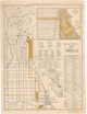
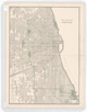
Map of Chicago and suburbs. | Chicago (Ill.)--Maps. | Scale [ca. 1:50,000]. Chicago : Charles T. Gilbert Real Estate, 1890. 1 map : col. ; 89 x 59 cm. |
    |
Rand McNally and Co.'s standard map of Chicago. | Chicago (Ill.)--Maps. | Scale [ca. 1:20,000]. Chicago, Ill. : Rand McNally & Co., 1892. 1 map on 4 sheets : col. ; 190 x 112 cm. |
 |
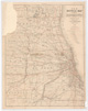
Map of Cook County, Illinois, showing Chicago, its suburbs, and railroad connections / compiled by F.C. Rossiter. | Chicago (Ill.)--Maps. Cook County (Ill.)--Maps. |
Scale [ca. 1:170,000]. Chicago : F.C. Rossiter, 1893. 1 map ; 45 x 39 cm. |
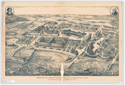 |
World's Columbian Exposition, 1893, Chicago, Ill., U.S.A. : bird's eye view, area 260 acres. (See note.) | World's Columbian Exposition (1893 : Chicago, Ill.)--Aerial views. | Not drawn to scale. Chicago : Kurz & Allison, c1891. 1 view ; 64 x 97 cm. |
 |
[World's Columbian Exposition]. | World's Columbian Exposition (1893 : Chicago, Ill.)--Maps. | Scale [1:7,008]. Chicago : Rand McNally, 1892. 1 map : col. ; 36 x 49 cm. |
 |
Map of the World's Columbian Exposition grounds and vicinity, Chicago, Illinois, 1893 / prepared expressly for Raymond & Whitcomb's Exposition Tours. | World's Columbian Exposition (1893 : Chicago, Ill.)--Maps. | Scale [ca. 1:8,450]. [Chicago] : Raymond & Whitcomb, 1893. 1 map ; 31 x 45 cm. |
 |
Chicago Tribune's Columbian souvenir map of Chicago and the World's Fair / [by Rand, McNally and Co.] ; copyright by the Chicago Tribune. | World's Columbian Exposition (1893 : Chicago, Ill.)--Maps. Central business districts--Illinois--Chicago--Maps. |
Scale 1:47,520. Chicago : Rand McNally and Co., c1893. 1 map : col. ; 60 x 45 cm. |
  |
Rand McNally & Co.'s handy map of Chicago and the World's Fair, 1893. | Chicago (Ill.)--Maps. World's Columbian Exposition (1893 : Chicago, Ill.)--Maps. |
Scale [ca. 1:42,000]. Chicago : Rand McNally, 1893. 1 map : col. ; 49 x 32 cm. Alternate title: Rand McNally & Co.'s indexed guide map and key to World's Fair buildings, grounds, and exhibits with handy map of Chicago. |
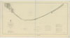 |
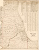
Lake Michigan coast chart. No. 5, New Buffalo to Chicago. | Michigan, Lake--Maps. Nautical charts--Michigan, Lake. |
Scale [1:80,000]. [Detroit : Lake Survey, 1894]. 1 map ; 66 x 106 cm. |
    |
The Sanitary District of Chicago : a map / prepared by the Sanitary District. | Chicago (Ill.)--Maps. Chicago Region (Ill.)--Maps. |
Scale [ca. 1:31,680]. Chicago : Sanitary District of Chicago, 1895. 1 map ; 199 x 150 cm. |
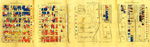 |
Nationalities map no. 1[-4], Polk St. to Twelfth ... Chicago. | Ethnology--Illinois--Chicago--Maps. Near West Side (Chicago, Ill.)--Maps. |
Scale [ca. 1:1,865]. New York : Thomas Y. Crowell & Co., 1895. 4 maps on 1 sheet : col. ; sheet 36 x 112 cm. |
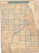 |
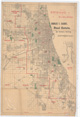
Cook and Du Page Counties. | Chicago (Ill.)--Maps. Chicago Region (Ill.)--Maps. |
Scale [ca. 1:72,500]. [Chicago] : Rufus Blanchard, 1897. 1 map : col. ; 100 x 88 cm. |
    |
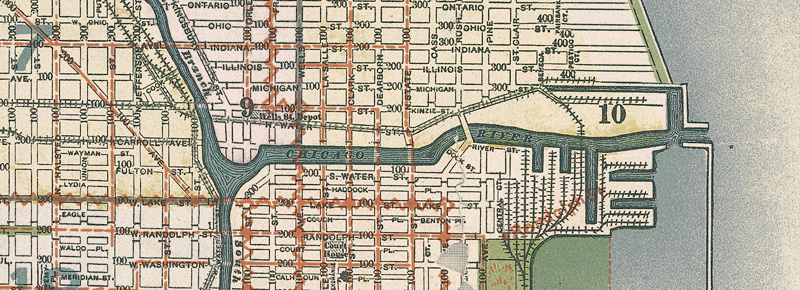
New map of Chicago showing street car lines in colors and street numbers in even hundreds / Rufus Blanchard. | Local transit--Illinois--Chicago--Maps. Local transit--Illinois--Chicago Metropolitan Area--Maps. |
Scale [ca. 1:21,000]. Chicago : Rufus Blanchard, 1897. 1 map : col. ; 216 x 118 cm. |
    |
New map of Chicago showing location of schools, street car lines in colors and street numbers in even hundreds / Rufus Blanchard. | Schools--Illinois--Chicago--Maps. Local transit--Illinois--Chicago--Maps. |
Scale [ca. 1:21,000]. Chicago : Rufus Blanchard, 1897. 1 map : col. ; 216 x 118 cm. |
 |
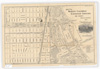
Street guide map of Chicago. | Chicago (Ill.)--Maps. | Scale [ca. 1:31,500]. [Chicago] : Rand, McNally & Co., [between 1897 and 1899]. 1 map : col. ; 67 x 49 cm. |
 |
New bicycle map showing carriage roads, also railroads, junction points, stations, post offices & villages. | Bicycle trails--Illinois--Chicago Metropolitan Area--Maps. | Scale [ca. 1:190,000]. [Chicago] : Rufus Blanchard, 1897. 1 map : col. ; 62 x 50 cm. |
 |
New bicycle map showing railroads, junction points, stations, postoffices & villages, also carriage roads. | Bicycle trails--Illinois--Chicago Metropolitan Area--Maps. | Scale [ca. 1:175,000]. Chicago : A.M. Askevold, 1898. 1 map : hand col. ; 72 x 56 cm. |
 |
Rand McNally & Co.'s railway terminal map of Chicago and its environs. | Railroads--Illinois--Chicago--Maps. Chicago (Ill.)--Maps. |
Scale [ca. 1:100,000]. [Chicago] : Rand McNally & Co., 1899, c1893. 1 map : hand col. ; 114 x 90 cm. |

