Earth Day spatial resources spotlight: USGS EarthExplorer
In celebration of Earth Day, the University of Chicago Library is spotlighting spatial data resources for environmental research and learning.
Remote sensing is also an important technology for many Earth science disciplines, such as hydrology, ecology, and oceanography. Researchers can retrieve information about an object or phenomenon without on-site observation. The University of Chicago Library Map Collection collects remotely sensed data, such as aerial imagery, and refers students and faculty to the many robust open access resources available.
EarthExplorer, provided by U.S. Geological Survey, is an open access tool to query, search, and order remotely sensed products, such as air photos, satellite imagery, and radar data. Many of the data are free and open to the public after creating a login.
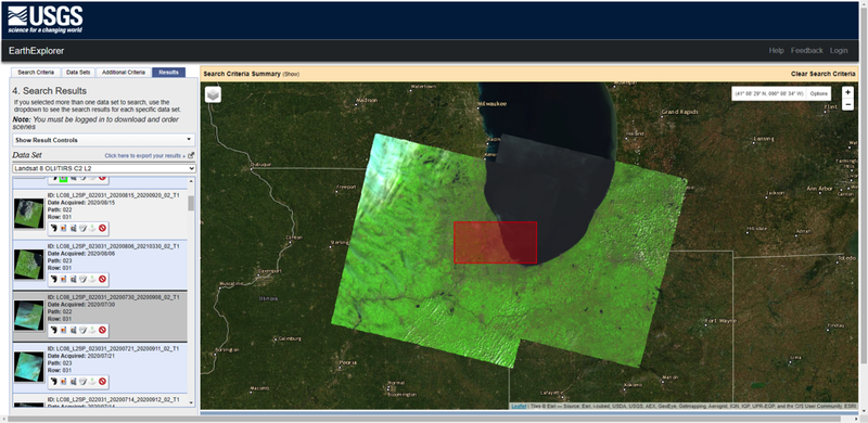
Pictured here is the EarthExplorer interface showcasing Landsat 8 imagery covering the Greater Chicago region. In addition to the visible RGB bands, the additional invisible bands, such as coastal aerosol, near infrared, and thermal infrared, can help researchers study urban sprawl, health of vegetation, air pollution, algae boom, and more.
For help accessing and using these spatial data resources please contact the GIS & Maps Librarian Cecilia Smith, ceciliasmith@uchicago.edu.

