Browse by
| Collections | |||
|---|---|---|---|
| Collection Thumbnail | Title | Formats | Subjects |
|
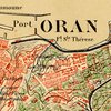
19th-Century Maps of the Middle East, North Africa, and Central Asia 19th-century maps of the Middle East, North Africa, and Central Asia. Most of these maps were published in Western Europe, and nearly all the others were published in Russia or in the United States. The maps are products of--or were designed to support--the major European and Russian activities in the region: exploration, scientific research, resource exploitation, conquest, and administration. |
Formats Digital Maps |
Subjects Middle East African Studies Slavic/Eastern Europe/Eurasia Geography |

|
The Maps of Heinrich Kiepert Geographer Heinrich Kiepert (1818-1899) is generally reckoned one of the more important scholarly cartographers of the second half of the 19th century. This Web page provides access to some Kiepert maps held at the University of Chicago Library's Map Collection. |
Formats Digital Maps |
Subjects Classics Middle East Geography Maps |