Browse by
Limit to
| Exhibit Thumbnail | Title | Locations | Subjects |
|---|---|---|---|
| Exhibits | |||
|
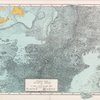
Marie Tharp: Pioneering Oceanographer
A pioneer in her field, renowned cartographer Marie Tharp created the first scientific maps of the Atlantic Ocean floor with her partner Bruce Heezen. Her observations showed the topography and geographical landscape of the ocean bottom and were crucial to the development of the theories of plate tectonics and continental drift in the earth sciences. |
View web exhibit >> |
Subjects
History of Science Geography Geophysical Sciences |
|
World Views: Maps and Atlases from Home to Research Library
This exhibition of maps and atlases, spanning the period from the late fifteenth through the early twentieth century, illustrates the uses of maps for recording, disseminating, and studying worldviews. |
Locations
The Hanna Holborn Gray Special Collections Research Center Sept. 1 — Dec. 1, 1999 |
Subjects
Geography |