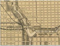
During the 1920s, 1930s, and 1940s, there was a slow growth in the planning role of municipal governments in many large American cities, including Chicago. Cartographic materials of various sorts were one of the byproducts of this growth. This Web page provides access to some government maps of Chicago from this period that are held at the University of Chicago Library's Map Collection.
Many of these maps were compiled to assist in the implementation of particular programs. In 1922, for example, the Chicago Zoning Commission, in order to facilitate the creation of Chicago's first zoning law, compiled the first land-use map of Chicago. In the 1930s, government agencies, having acquired a mandate from the New Deal to try to alleviate urban poverty, produced maps that showed the geography of substandard housing, redlined areas, population loss, and relief distribution. As World War II began to draw to a close, the Chicago Plan Commission compiled maps in which major postwar planning efforts were proposed, and in 1946 it published the first detailed land use plan for Chicago. Many features included in on this map--certain highways and rail lines, for example--not to mention a population of 3.8 million in 1965--never quite came to pass, but the postwar city of freeways, new government-built rapid-transit lines, and large-scale urban renewal was sketched out in detail for the first time.
Other government maps from the 1920s, 1930s, and 1940s were essentially descriptive, for example, the Chicago Regional Planning Association's maps of industrial employees, subdivided land, and rail commutation time. Other "descriptive" maps focused on the work of long-existing government agencies, for example, the Sanitary Commission, the U.S. Army Corps of Engineers, the Chicago Park District, and the Cook County Forest Preserve District. Late in the 1920s, the U.S. Geological Survey, in conjunction with the Illinois Geological Survey, produced prototypes of its new 7.5 minute 1:24,000 series of topographic maps for a large part of northeastern Illinois. These maps differed from what would become the standard 7.5 minute sheets in showing individual buildings, at least in a stylized form, even in urban areas. Thus, the 1928-1929 set of USGS topographic maps of the Chicago area gives an extraordinary sense of the texture of the built environment that later editions do not.