Browse by
| Collections | |||
|---|---|---|---|
| Collection Thumbnail | Title | Formats | Subjects |
|
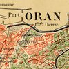
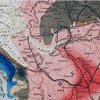
19th-Century Maps of the Middle East, North Africa, and Central Asia 19th-century maps of the Middle East, North Africa, and Central Asia. Most of these maps were published in Western Europe, and nearly all the others were published in Russia or in the United States. The maps are products of--or were designed to support--the major European and Russian activities in the region: exploration, scientific research, resource exploitation, conquest, and administration. |
Formats Digital Maps |
Subjects Middle East African Studies Slavic/Eastern Europe/Eurasia Geography |
|
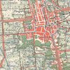
Asian Cities - Late 19th- and early 20th-century maps Late 19th- and early 20th-century sheet maps of Asian (or partly Asian) cities that are held at the University of Chicago Library's Map Collection. Several of the cities portrayed in these maps are now among the world's largest, but they were all much smaller places during the years when the maps were compiled. |
Formats Digital Maps |
Subjects Chinese Studies Japanese Studies Korean Studies Maps |
|
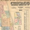
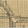
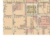
Before and after the fire: Chicago in the 1860s, 1870s, and 1880s Sheet maps of Chicago from the 1860s, 1870s, and 1880s that are held at the University of Chicago Library's Map Collection. |
Formats Digital Maps |
Subjects Chicago and Illinois History Maps |
|
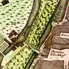
Central Europe - 18th-Century Maps Maps of the area in the middle part of Europe that, in the 18th century, was largely administered by members of the German-speaking nobility. Its boundaries, with some notable exceptions, coincided roughly with those of the then somewhat moribund Holy Roman Empire. It incorporated present-day Germany, Austria, Hungary, and the Czech Republic, and large parts of Poland, Slovakia, Slovenia, and the Kaliningradskaia oblast' as well as northeastern Italy and German-speaking Switzerland. |
Formats Digital Maps |
Subjects European History Slavic/Eastern Europe/Eurasia Geography Maps |
|
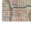
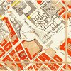
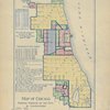
Chicago in the 1890s Sheet maps of Chicago in the 1890s that are held at the University of Chicago Library's Map Collection. The 1890s were an extraordinary decade for Chicago, perhaps the only period in the city's history when its status as a "world city" would be disputed by few. |
Formats Digital Maps |
Subjects American History Chicago and Illinois Maps Geography |
|
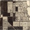
Chicago in the 1920s and 1930s: the view from the Chicago School (the Social Science Research Committee maps) "During the 1920s and 1930s numerous scholars at the University of Chicago did research on Chicago itself. These scholars, whose work is sometimes associated with the label "Chicago School," or "Chicago School of Sociology," played a major role in establishing urban studies as an important academic enterprise. All of these maps were produced under the aegis of the Social Science Research Committee or its immediate predecessor, the Local Community Research Committee. |
Formats Digital Maps |
Subjects Sociology American History Chicago and Illinois Maps |
|
Chicago, 1900-1914 Sheet maps of Chicago from the years between 1900 and the onset of World War I. The maps portray a city where much that was true of Chicago in the 1890s remained the case. Chicago continued to grow, reaching a population (not counting suburbs) of nearly 2.2 million in 1910, and perhaps 2.4 million in 1914, when (by some measures) it was still the world’s sixth largest city. |
Formats Digital Maps |
Subjects Chicago and Illinois American History Maps |
|
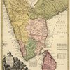
Digital South Asia - Maps Catalogs of maps and maps themselves, ranging from historical to topographic as well as GIS data |
Formats Digital Maps |
Subjects Maps South Asia Southern Asia |
|
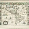
Early Modern Maps of the Americas The Early Modern Maps of the Americas Collection follows the representation of the Americas in early modern cartography. The maps date from the 16th through the 18th centuries giving a wide perspective of how the Americas were illustrated. |
Formats Digital Maps |
Subjects European History Geography Maps Native American Studies Special Collections |

|
Ethnographic Maps of the 19th Century 19th-century ethnographic maps that are held at the University of Chicago Library's Map Collection. Most of these maps show the distribution of particular ethnic groups or languages. A few show the geography of other aspects of culture. |
Formats Digital Maps |
Subjects Sociology Anthropology Maps |
|
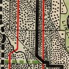
European Transportation Maps of the 19th Century Maps showing European transportation facilities during the 19th century documenting an extraordinary change. At the beginning of the 19th century movement was largely along dirt roads and depended on horses or foot travel. By the end of the 19th century, transportation had become enormously faster, more reliable, and more comfortable. I that did not show railroad lies. |
Formats Digital Maps |
Subjects History European History Maps |
|
Government maps of Chicago in the 1920s, 1930s, and 1940s During the 1920s, 1930s, and 1940s, there was a slow growth in the planning role of municipal governments in many large American cities, including Chicago. Cartographic materials of various sorts were one of the byproducts of this growth. |
Formats Digital Maps |
Subjects American History Political Science Chicago and Illinois Maps Geography |
|
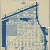
Late 19th- and Early 20th-Century European City-Planning Maps Late 19th- and early 20th-century European city-planning maps that are held at the University of Chicago Library's Map Collection. Some are maps of actual plans for the future, not all of which (for example those of Cabourg and Moscow) were actually carried out. |
Formats Digital Maps |
Subjects History Political Science Maps |
|
Latin American Cities - Late 19th- and early 20th-century maps Late 19th- and early 20th-century sheet maps of Latin American cities that are held at the University of Chicago Library's Map Collection. |
Formats Digital Maps |
Subjects History Latin American Studies Maps Geography |
|
Mapping Chicagoland Collection The Mapping Chicagoland Collection is a digital collection that draws together cartographic works of Chicago from 1812 through 1940 from the University of Chicago Library, the Newberry Library, and the Chicago History Museum. The wide range of topics represented on the maps include land use, urban planning, transportation, utilities, annexations, wards, industries, topography, cemeteries, world’s fairs, and population. The collection includes a mix of maps and atlas pages totaling over 4,000 maps that are enriched with geospatial data. |
Formats Digital Maps |
Subjects Maps |

|
The Maps of Heinrich Kiepert Geographer Heinrich Kiepert (1818-1899) is generally reckoned one of the more important scholarly cartographers of the second half of the 19th century. This Web page provides access to some Kiepert maps held at the University of Chicago Library's Map Collection. |
Formats Digital Maps |
Subjects Classics Middle East Geography Maps |
|
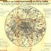
Paris in the 19th Century Maps and views of 19th-century Paris that are held at the University of Chicago Library's Map Collection. The maps document the transformation of Paris from a compact city of half a million in 1800 into an industrial metropolis of nearly 3.5 million a century later. |
Formats Digital Maps |
Subjects History Maps European History Geography |

|
Planning Maps of Midwestern Cities in the 1920s and 1930s Government planning maps of Midwestern cities from the 1920s and 1930s. Most of the maps are zoning or land-use maps. |
Formats Digital Maps |
Subjects Political Science American History Maps Geography |
|
Social Scientists Map Chicago Geographer Chauncy Harris often argued that Chicago in the first half of the 20th century was the most studied city in the world. This claim is unprovable, but there were certainly an enormous number of scholarly studies of Chicago between the 1920s and the middle of the 20th century. Many of these included maps. |
Formats Digital Maps |
Subjects Sociology Political Science American History Chicago and Illinois Maps |

|
The Speculum Romanae Magnificentiae A digital version of the Library's extensive collection of Antonio Lafreri's Renaissance-era Speculum Romanae Magnificentiae prints and maps which depicted major monuments and antiquities in Rome. The site also contains a set of virtual itineraries through Rome, guided by scholars from around the country. |
Formats Digital Images Maps |
Subjects Classics European History Art Architecture |
|
Urban Rail Transit - Late 19th- and early 20th-century maps Late 19th- and early 20th-century urban rail transit maps that roughly illustrate the history of urban rail transit between the 1860s and the 1920s. These years were the heyday of urban rail transit. Virtually every city in the Western world and in its colonial offshoots had street railroads during much or all of this period. |
Formats Digital Maps |
Subjects History Maps European History American History |