Maps showing European transportation facilities during the 19th century that are held at the University of Chicago Library's Map Collection.
The maps document an extraordinary change. At the beginning of the 19th century movement was largely along dirt roads and depended on horses or walking. Canals, some associated with the nascent Industrial Revolution, existed in a few places, but movement along the canals was also dependent on animal power. It could take weeks to cross Europe. By the end of the 19th century, transportation had become enormously faster, more reliable, and more comfortable. Steam railroad lines had penetrated everywhere except parts of Eastern Europe, northern Scandinavia, and the High Alps. Roads, even though they were starting to be paved, were secondary except at the very local level. Waterways continued to be important for bulk freight.
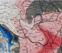
The maps shown are a tiny subset of all the European transportation maps produced in the 19th century. They were chosen to be representative rather then comprehensive.
Access Information
Numerous additional titles at the University of Chicago Library--and in other North American libraries--can be found by searching with Library of Congress subject headings. Examples include "Railroads--[Place name]--Maps, " "Roads--[Place name]--Maps, " "Inland navigation--[Place name]--Maps, " "Shipping--[Place name]--Maps, " and "Transportation--[Place name]--Maps." General maps also often show transportation facilities; it is hard to imagine a map of almost anywhere in Europe published between, say, the 1840s and World War I that did not show railroad lies.