Browse by
| Collections | |||
|---|---|---|---|
| Collection Thumbnail | Title | Formats | Subjects |
|
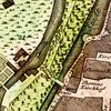
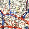
Central Europe - 18th-Century Maps Maps of the area in the middle part of Europe that, in the 18th century, was largely administered by members of the German-speaking nobility. Its boundaries, with some notable exceptions, coincided roughly with those of the then somewhat moribund Holy Roman Empire. It incorporated present-day Germany, Austria, Hungary, and the Czech Republic, and large parts of Poland, Slovakia, Slovenia, and the Kaliningradskaia oblast' as well as northeastern Italy and German-speaking Switzerland. |
Formats Digital Maps |
Subjects European History Slavic/Eastern Europe/Eurasia Geography Maps |

|
Earl J. Hamilton Collection on the History of Economics The Earl J. Hamilton Collection on the History of Economics contains over 3,000 rare and scholarly titles, with particular strengths in the economy of Spain and the life of John Law of Lauriston. |
Formats Books & Journals |
Subjects Economics Special Collections European History |
|
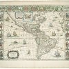
Early Modern Maps of the Americas The Early Modern Maps of the Americas Collection follows the representation of the Americas in early modern cartography. The maps date from the 16th through the 18th centuries giving a wide perspective of how the Americas were illustrated. |
Formats Digital Maps |
Subjects European History Geography Maps Native American Studies Special Collections |
|
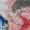
European Transportation Maps of the 19th Century Maps showing European transportation facilities during the 19th century documenting an extraordinary change. At the beginning of the 19th century movement was largely along dirt roads and depended on horses or foot travel. By the end of the 19th century, transportation had become enormously faster, more reliable, and more comfortable. I that did not show railroad lies. |
Formats Digital Maps |
Subjects History European History Maps |
|
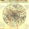
Paris in the 19th Century Maps and views of 19th-century Paris that are held at the University of Chicago Library's Map Collection. The maps document the transformation of Paris from a compact city of half a million in 1800 into an industrial metropolis of nearly 3.5 million a century later. |
Formats Digital Maps |
Subjects History Maps European History Geography |

|
Russian Satirical Journals, 1905-1907 The University of Chicago Library’s collection Russian Satirical Journals, 1905-1907 consists of 110 titles in 378 issues. It is primarily comprised of journals, but some newspapers, broadsides, and illustrated periodicals are also included. The full collection has been digitized. This collection documents some of the most important events of the period known as the first Russian Revolution of 1905-1907. It was during this unprecedented rise of national self-identity that the first Russian Constitution and Russian Parliament were initially created. The first Russian Revolution was a period of struggle for political, social and human rights, and the press, which had previously been subject to censorship, enjoyed a new freedom which had never before appeared in Russia. |
Formats Digital Books & Journals |
Subjects History Slavic/Eastern Europe/Eurasia European History Political Science |

|
The Speculum Romanae Magnificentiae A digital version of the Library's extensive collection of Antonio Lafreri's Renaissance-era Speculum Romanae Magnificentiae prints and maps which depicted major monuments and antiquities in Rome. The site also contains a set of virtual itineraries through Rome, guided by scholars from around the country. |
Formats Digital Images Maps |
Subjects Classics European History Art Architecture |
|
Urban Rail Transit - Late 19th- and early 20th-century maps Late 19th- and early 20th-century urban rail transit maps that roughly illustrate the history of urban rail transit between the 1860s and the 1920s. These years were the heyday of urban rail transit. Virtually every city in the Western world and in its colonial offshoots had street railroads during much or all of this period. |
Formats Digital Maps |
Subjects History Maps European History American History |