Click on the links below to access scans of some of the maps and views of 19th-century Paris that are held at the University of Chicago Library's Map Collection.
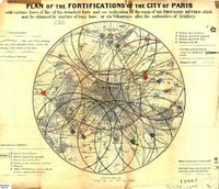
The maps document the transformation of Paris from a compact city of half a million in 1800 into an industrial metropolis of nearly 3.5 million a century later. In the intervening years Paris acquired a more or less modern water system with the building of the Canal de l'Ourcq (1802-1822). It became the center of an elaborate railway network (starting from the 1840s). Numerous new streets, many created under the aegis of Baron Haussmann (in the 1850s and 1860s), were run through the old medieval core. Construction of an underground railroad system (the Métro) began (the first line opened in 1900). And an elaborate system of fortifications was built--which did not prevent French defeat in the Franco-Prussian War.
Many of the maps come from the collection of cartographic materials that was assembled by French geographer Emile Levasseur (1828-1911), bought by the old John Crerar Library in 1914, and acquired by the University of Chicago Library in 1930-1931.
We have included several maps whose compilers, publishers, and dates of production we do not know. We would be very grateful for information that would allow us to identify these publications with greater precision.
This page provides access only to a small proportion of the Paris maps that are held at the University of Chicago Map Collection. Additional maps are listed in the Library's on-line catalog. The best way to find them is probably to do subject keyword searches on "Paris and maps" and "Paris and views," limiting by date (and perhaps format). This approach should work for finding English-language records on WorldCat and in other North American libraries' catalogs as well. Doing this search on WorldCat also turns up several Paris maps on the Internet. Additional maps of the Paris area can be found in most libraries' collections of topographic maps.
View Online Collection