Government planning maps of Midwestern cities from the 1920s and 1930s that are held at the University of Chicago Library's Map Collection. (For comparable maps of Chicago, see the companion Web page, Government Maps of Chicago in the 1920s, 1930s, and 1940s.)
Most of the maps are zoning or land-use maps. The relationship between zoning and land use in American cities is close but not simple. No one--at least before the era Êof large-scale "urban renewal"--would have proposed a zoning code for a settled neighborhood that involved a complete change in land use. Chicago's first land-use map was compiled explicitly to facilitate the writing of the city's first zoning ordinance. It is possible (but not provable) that most of the zoning of populated areas in the maps indexed below represents a radically simplified, idealized portrait of actual land use.
The kind of land use regulation shown in these maps came late to the United States, but it spread quickly in the years after New York's 1916 adoption of what was apparently the first American city-wide zoning code. Many, perhaps most, American cities--even small ones--promulgated similar laws over the next decade and a half*. A 1939 map shows that virtually all Minnesota cities had zoning laws by the end of the 1930s.
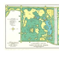
We have also included a few other kinds of planning maps: for example, a census-block map of Detroit; a parking-lot map of central Detroit; a street plan for Milwaukee; and a map of Milwaukee's Parklawn, one of the country's first housing projects. Some of the larger cities portrayed in these maps have become notorious for their problems.
Since the 1950s, Detroit and, to a lesser extent, a few other Midwestern cities have lost a substantial part of their population and housing stock. The maps indexed on this Web page predate this decline. The maps' compilers expected that the cities would continue to grow indefinitely--and that their central portions would become considerably denser.
We have included several maps whose compilers, publishers, and dates of production we do not know. We would be very grateful for information that would allow us to identify these publications with greater precision.
View Online Collection