1957: Atlantic Ocean Map
In 1957, the first physiographic map of the Atlantic Ocean was published by the Lamont Geological Observatory of Columbia University based on Marie and Bruce’s data. The University Map Collection is fortunate enough to have a 1957 printing of this same map. It depicts all of the sounding measurements gathered by the observatory’s vessels in the 1940s and 1950s with a three-dimensional approach to underwater altitudes. This map is the physical manifestation of years of research in the Mid-Atlantic Ridge, which was officially presented at a continental drift conference in 1956. The effort Marie exerted in drafting the Atlantic Ocean map served as a launching point for Marie’s career and for discussions on rift theory.
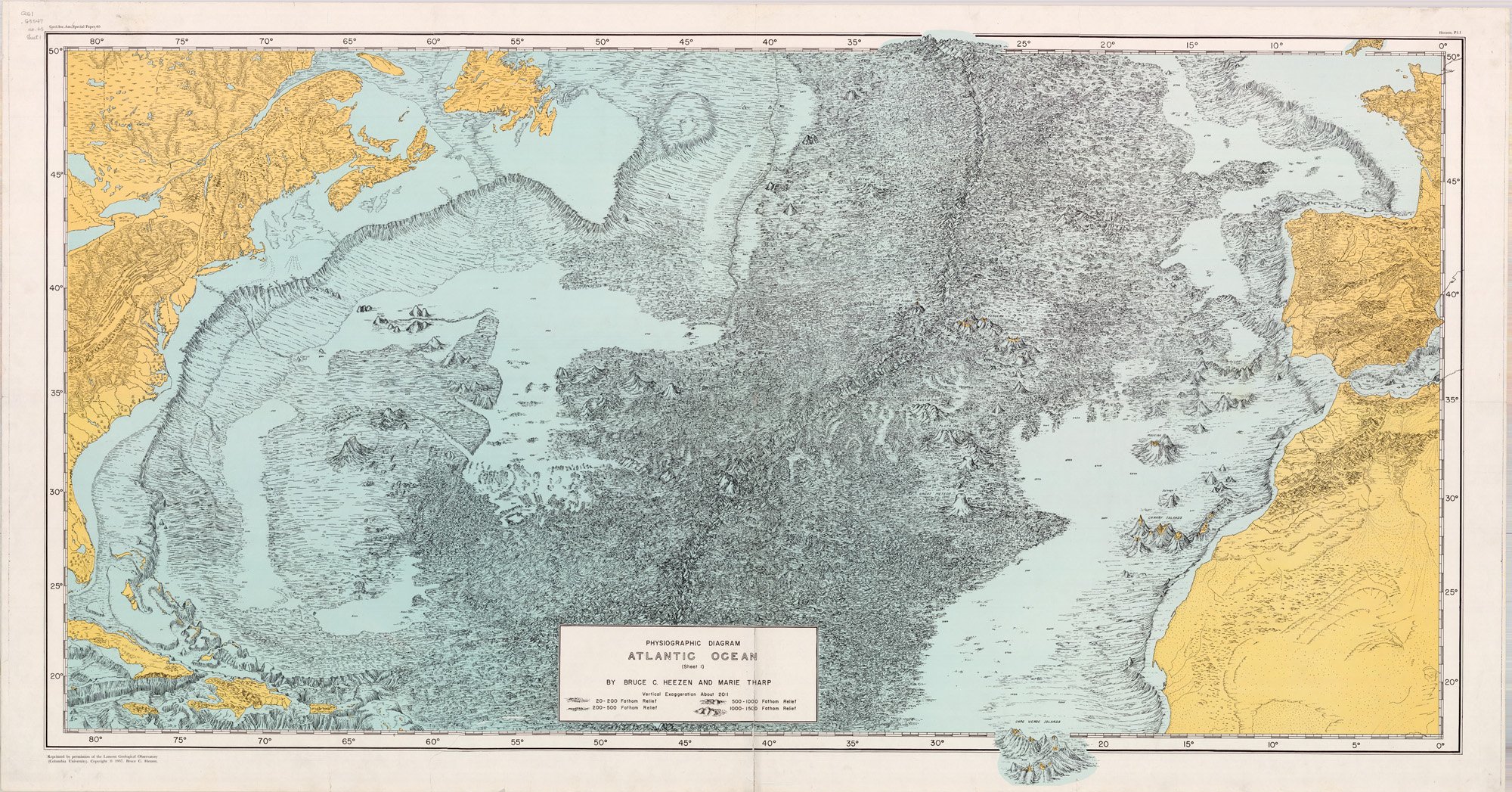
Physiographic Diagram of the Atlantic Ocean. Maps Collection, Regenstein Library: G9101.C2 1957 H.4
Reproduced by permission of Marie Tharp Maps, LLC 8 Edward St. Sparkill, NY 10976.