1967: Indian Ocean Map
As soon as the first Indian Ocean Map became accessible to the public, National Geographic consigned Marie and Bruce as consultants for an updated physiographic map using information from the latest International Indian Ocean Expedition. Heinrich Berran, an artist from Austria, was commissioned to do the painting for the project. Their collaboration was a success and Marie reflects how Heinrich’s, “familiarity with painting the Alps translated beautifully to the seafloor.”[1] When the Indian Ocean Map was published in 1967, it marked only the first of many oceanic panoramas they would produce together. They charted ocean floors around the world for National Geographic between 1967 and 1975. Both the 1967 National Geographic Indian Ocean Map and a 1975 Antarctic Region Map can be found in the Map Collection in the library.
[1] Marie Tharp, “Connect the Dots: Mapping the Seafloor and Discovering the Mid-Ocean Ridge,” Lamont-Doherty Earth Observatory of Columbia: Twelve Perspectives on the First Fifty Years 1949-1999, Last modified April 1, 1999, Edited by Laurence Lippsett. https://www.whoi.edu/page.do?pid=7500&tid=7342&cid=23306.
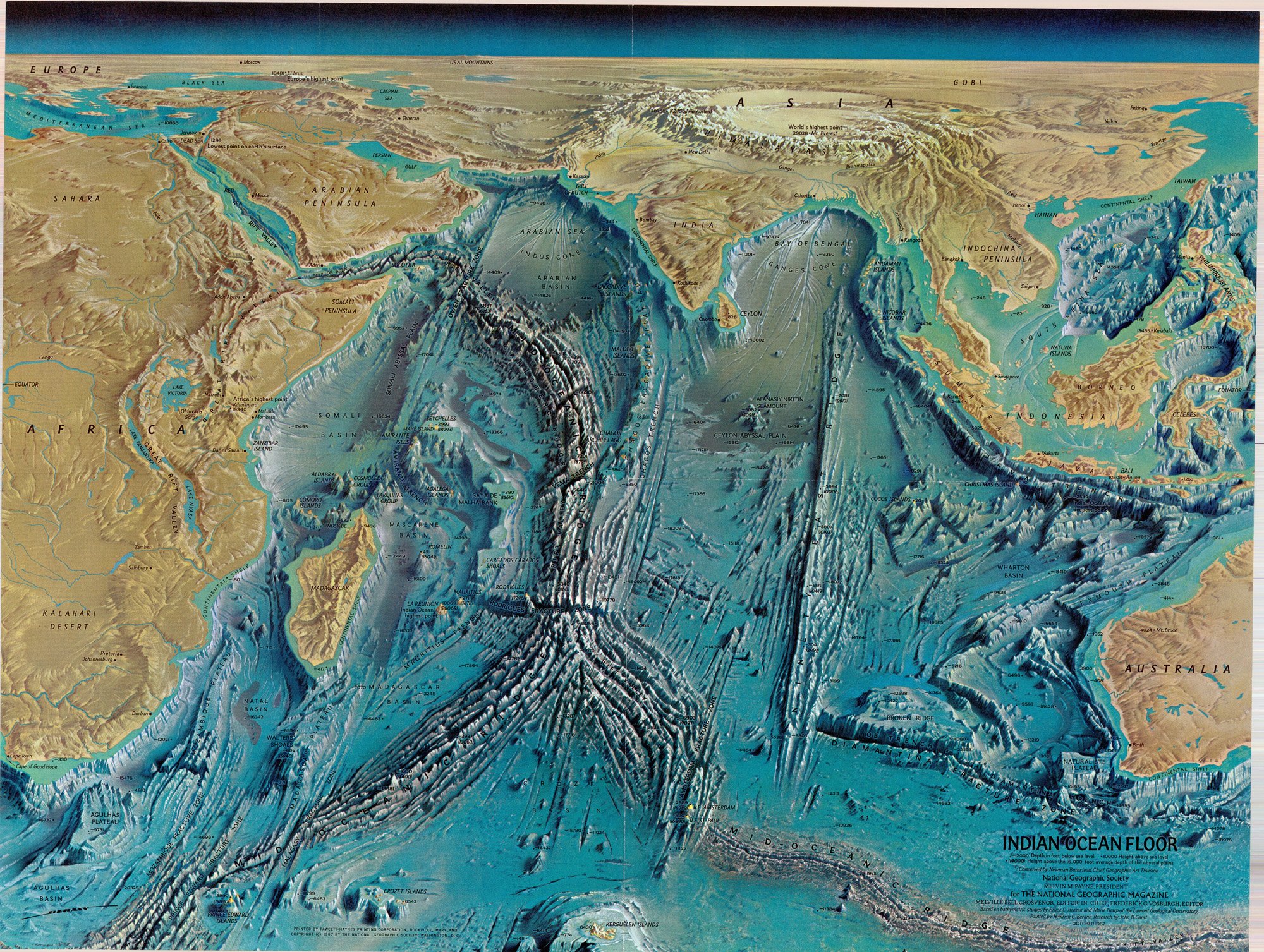
Indian Ocean Floor. Map Collection. Regenstein Library: G9181.C2 1967 .N3 MapCl c.1
Reproduced by permission of Marie Tharp Maps, LLC 8 Edward St. Sparkill, NY 10976.